Файл:Map of Jupiter (square).jpg

Розмір при попередньому перегляді: 600 × 600 пікселів. Інші роздільності: 240 × 240 пікселів | 480 × 480 пікселів | 768 × 768 пікселів | 1024 × 1024 пікселів | 2160 × 2160 пікселів.
Повна роздільність (2160 × 2160 пікселів, розмір файлу: 409 КБ, MIME-тип: image/jpeg)
| Відомості про цей файл містяться на Вікісховищі — централізованому сховищі вільних файлів мультимедіа для використання у проектах Фонду Вікімедіа. |
Опис файлу
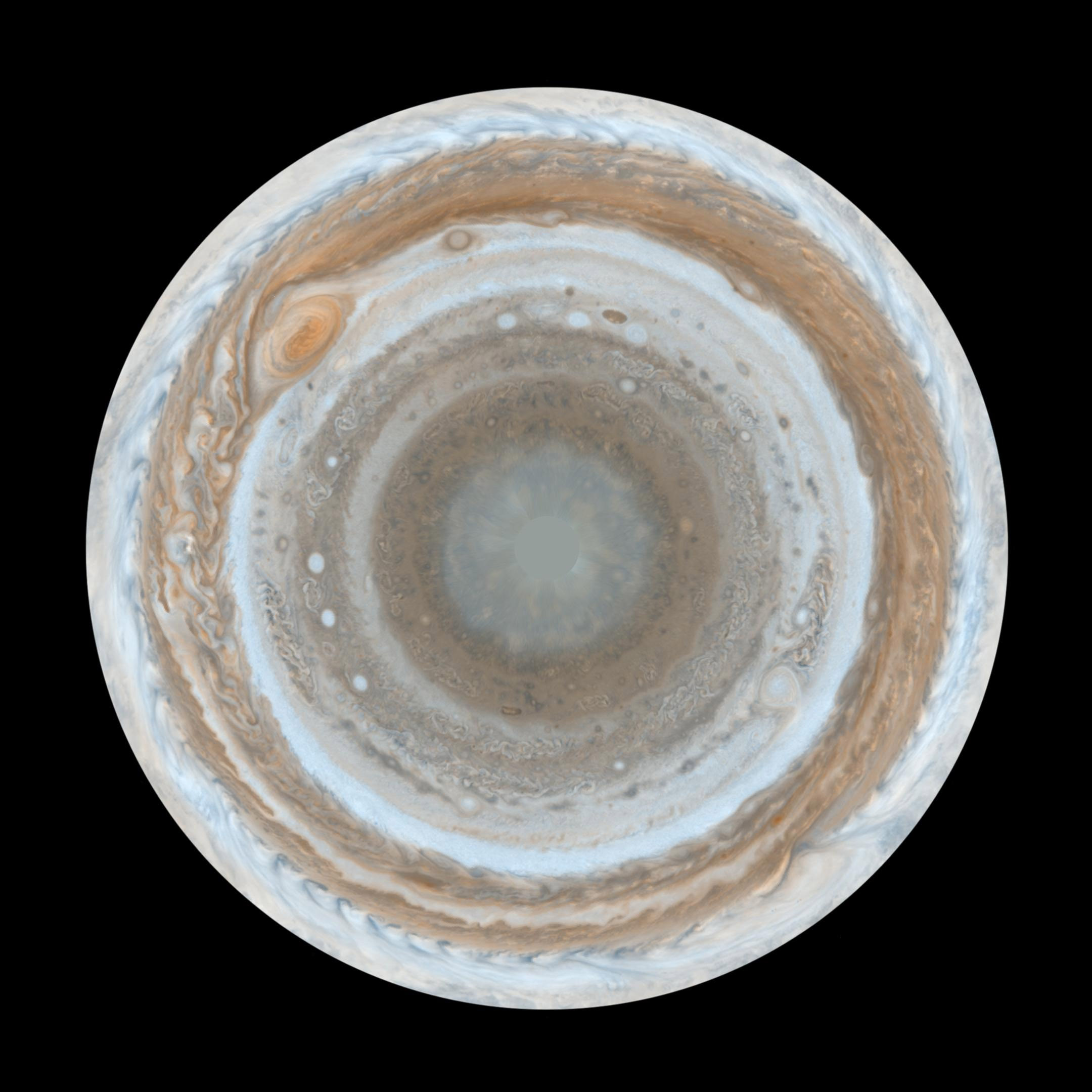
| Опис | English: :This map of Jupiter is the most detailed global color map of the planet ever produced. The round map is a polar stereographic projection that shows the south pole in the center of the map and the equator at the edge. It was constructed from images taken by Cassini on Dec. 11 and 12, 2000, as the spacecraft neared Jupiter during a flyby on its way to Saturn. The map shows a variety of colorful cloud features, including parallel reddish-brown and white bands, the Great Red Spot, multi-lobed chaotic regions, white ovals and many small vortices. Many clouds appear in streaks and waves due to continual stretching and folding by Jupiter's winds and turbulence. The bluish-gray features along the north edge of the central bright band are equatorial "hot spots," meteorological systems such as the one entered by NASA's Galileo probe. Small bright spots within the orange band north of the equator are lightning-bearing thunderstorms. The polar region shown here is less clearly visible because Cassini viewed it at an angle and through thicker atmospheric haze. |
| Час створення | 11-12 December 2000 |
| Джерело | From http://www.nasa.gov/multimedia/imagegallery/image_feature_539.html |
| Автор | NASA/JPL/Space Science Institute |
| Ліцензія (Повторне використання цього файлу) | PD-USGOV-NASA. |
| Інші версії | |


.jpg)
Ліцензування
| Цей файл перебуває у суспільному надбанні, оскільки він був створений NASA (Національним управлінням з аеронавтики і дослідження космічного простору). Згідно з політикою NASA стосовно авторського права, «матеріали NASA не захищаються авторським правом, якщо не вказано протилежне». (Див. Template:PD-USGov, сторінку політики NASA стосовно авторського права, або політику використання зображень JPL.) | ||
 | Попередження:
|
Історія файлу
Клацніть на дату/час, щоб переглянути, як тоді виглядав файл.
| Дата/час | Мініатюра | Розмір об'єкта | Користувач | Коментар | |
|---|---|---|---|---|---|
| поточний | 00:00, 1 грудня 2019 | | 2160 × 2160 (409 КБ) | User-duck | File:Map of Jupiter.jpg cropped square using CropTool with lossless mode. |
Використання файлу
Така сторінка використовує цей файл:
Глобальне використання файлу
Цей файл використовують такі інші вікі:
- Використання в en.wikipedia.org
- Використання в ko.wikipedia.org
- Використання в ro.wikipedia.org
.jpg)