Dosya:Russia edcp location map.svg
 Vikipedi, özgür ansiklopedi

Bu SVG dosyasının PNG önizlemesinin boyutu: 800 × 431 piksel. Diğer çözünürlükler: 320 × 173 piksel | 640 × 345 piksel | 1.024 × 552 piksel | 1.280 × 690 piksel | 2.560 × 1.381 piksel | 1.181 × 637 piksel.
Tam çözünürlük (SVG dosyası, sözde 1.181 × 637 piksel, dosya boyutu: 2,59 MB)
Bu dosya Wikimedia Commons'ta bulunmaktadır. Dosyanın açıklaması aşağıda gösterilmiştir. Commons, serbest/özgür telifli medya dosyalarının bulundurulduğu depodur. Siz de yardım edebilirsiniz. |
Özet
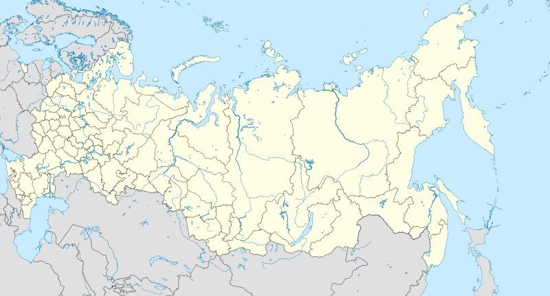
| Açıklama | English: Location map of Russia. EquiDistantConicProjection : Central parallel : * N: 54.0° N Central meridian : * E: 100.0° E Standard parallels: * 1: 49.0° N * 2: 59.0° N Made with Natural Earth. Free vector and raster map data @ naturalearthdata.com. Notice Russia other countries disputed areas international border disputed border Because the southern Kuril islands are claimed by Russia and Japan, they are shown as disputed. For more information about this see: en:Kuril Islands dispute. These islands are since 1945 under the jurisdiction of the Russian Federation. Русский: Схематическая карта России с границами субъектов федерации и водными ресурсами. Коническая равнопромежуточная проекция с центром по 54-й параллели северной широты и 100-му меридиану восточной долготы. На основе данных с сайта Natural Earth (www.naturalearthdata.com). Особенности:
Условные обозначения: Россия другие страны спорные территории общепризнанные границы спорные границы |
| Tarih | |
| Kaynak | Yükleyenin kendi çalışması |
| Yazar | Uwe Dedering |
| Diğer sürümler |
|

Lisanslama
Ben, bu işin telif sahibi, burada işi aşağıdaki lisans altında yayımlıyorum:
Bu dosya, Creative Commons Atıf-Benzer Paylaşım 3.0 Taşınmamış lisansı ile lisanslanmıştır
- Şu seçeneklerde özgürsünüz:
- paylaşım – eser paylaşımı, dağıtımı ve iletimi
- içeriği değiştirip uyarlama – eser adaptasyonu
- Aşağıdaki koşullar geçerli olacaktır:
- atıf – Esere yazar veya lisans sahibi tarafından belirtilen (ancak sizi ya da eseri kullanımınızı desteklediklerini ileri sürmeyecek bir) şekilde atıfta bulunmalısınız.
- benzer paylaşım – Maddeyi yeniden karıştırır, dönüştürür veya inşa ederseniz, katkılarınızı orijinal olarak aynı veya uyumlu lisans altında dağıtmanız gerekir.
Dosya geçmişi
Dosyanın herhangi bir zamandaki hâli için ilgili tarih/saat kısmına tıklayın.
| Tarih/Saat | Küçük resim | Boyutlar | Kullanıcı | Yorum | |
|---|---|---|---|---|---|
| güncel | 10.33, 27 Ocak 2016 | | 1.181 × 637 (2,59 MB) | Denniss | Reverted to version as of 11:36, 11 July 2015 (UTC) |
| 09.19, 27 Ocak 2016 |  | 1.201 × 637 (3,5 MB) | BasilLeaf | Crimea part of the Russia Federation according to the Russian Government. Wikipedia shall remain neutral in all affairs and locator maps of each individual country shall comply with that country's internal rules | |
| 11.36, 11 Temmuz 2015 |  | 1.181 × 637 (2,59 MB) | Denniss | Reverted to version as of 14:44, 17 August 2014 | |
| 07.24, 11 Temmuz 2015 |  | 1.201 × 637 (3,5 MB) | Doni Vëntersenz | Crimea is now a part of Russian Federation. | |
| 14.44, 17 Ağustos 2014 |  | 1.181 × 637 (2,59 MB) | Denniss | Reverted to version as of 20:53, 25 April 2014 - stop revert warring, it's clearly states this map is showing Kuril islands as disputed | |
| 14.01, 17 Ağustos 2014 |  | 1.181 × 637 (2,86 MB) | Nicolay Sidorov | Reverted to version as of 23:14, 6 July 2012 - спорный статус Курильских островов | |
| 20.53, 25 Nisan 2014 |  | 1.181 × 637 (2,59 MB) | Denniss | Reverted to version as of 16:09, 11 April 2014 | |
| 19.38, 25 Nisan 2014 |  | 1.201 × 637 (3,5 MB) | Логаритам | Reverted to version as of 15:44, 11 April 2014 and what? | |
| 16.09, 11 Nisan 2014 |  | 1.181 × 637 (2,59 MB) | NordNordWest | Reverted to version as of 15:33, 11 April 2014; please don't destroy all templates which are using this map | |
| 15.44, 11 Nisan 2014 |  | 1.201 × 637 (3,5 MB) | NoviSadGrad |
Dosya kullanımı
Bu görüntü dosyasına bağlanan sayfa yok.
Küresel dosya kullanımı
Aşağıdaki diğer vikiler bu dosyayı kullanır:
- af.wikipedia.org üzerinde kullanımı
- Oimjakon
- Moskouse Kremlin
- Drie-eenheid-klooster van Sint Sergius
- Rooiplein
- Kolomenskoje
- Nowodewitsji-klooster
- Wit Monumente van Wladimir en Soezdal
- Ferapontof-klooster
- Vulkane van Kamtsjatka
- Kazanse Kremlin
- Goue Berge van Altai
- Solowjetski-klooster
- Sjabloon:Liggingkaart Rusland
- Tsjeko-meer
- Wladiwostok Internasionale Lughawe
- Bulgar
- Poetoranaplato
- Koerilemeer
- als.wikipedia.org üzerinde kullanımı
- ar.wikipedia.org üzerinde kullanımı
- ast.wikipedia.org üzerinde kullanımı
Bu dosyanın daha fazla küresel kullanımını görüntüle.