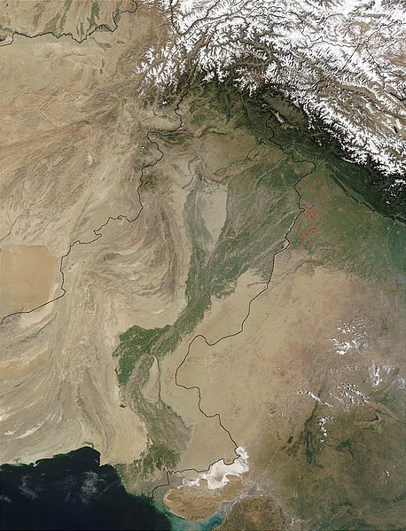
Dosya:Indus.A2002274.0610.1km.jpg
 Vikipedi, özgür ansiklopedi

Tam çözünürlük ((1.300 × 1.700 piksel, dosya boyutu: 480 KB, MIME tipi: image/jpeg))
Dosya geçmişi
Dosyanın herhangi bir zamandaki hâli için ilgili tarih/saat kısmına tıklayın.
| Tarih/Saat | Küçük resim | Boyutlar | Kullanıcı | Yorum | |
|---|---|---|---|---|---|
| güncel | 13.03, 28 Mart 2008 |  | 1.300 × 1.700 (480 KB) | File Upload Bot (Magnus Manske) | {{BotMoveToCommons|en.wikipedia}} {{Information |Description={{en|en:Satellite image of the en:Indus River basin. Red dots indicate fires. International boundaries are superimposed; the boundary through en:Jammu and Kashmir reflects the [[ |
Dosya kullanımı
Bu görüntü dosyasına bağlantısı olan sayfalar:
Küresel dosya kullanımı
Aşağıdaki diğer vikiler bu dosyayı kullanır:
- af.wikipedia.org üzerinde kullanımı
- ar.wikipedia.org üzerinde kullanımı
- arz.wikipedia.org üzerinde kullanımı
- ast.wikipedia.org üzerinde kullanımı
- as.wikipedia.org üzerinde kullanımı
- azb.wikipedia.org üzerinde kullanımı
- az.wikipedia.org üzerinde kullanımı
- ba.wikipedia.org üzerinde kullanımı
- be-tarask.wikipedia.org üzerinde kullanımı
- bh.wikipedia.org üzerinde kullanımı
- bn.wikipedia.org üzerinde kullanımı
- bo.wikipedia.org üzerinde kullanımı
- br.wikipedia.org üzerinde kullanımı
- bxr.wikipedia.org üzerinde kullanımı
- ca.wikipedia.org üzerinde kullanımı
- ceb.wikipedia.org üzerinde kullanımı
- ce.wikipedia.org üzerinde kullanımı
- ckb.wikipedia.org üzerinde kullanımı
- cy.wikipedia.org üzerinde kullanımı
- da.wikipedia.org üzerinde kullanımı
- en.wikipedia.org üzerinde kullanımı
- eo.wikipedia.org üzerinde kullanımı
- es.wikipedia.org üzerinde kullanımı
- fa.wikipedia.org üzerinde kullanımı
- fiu-vro.wikipedia.org üzerinde kullanımı
- gd.wikipedia.org üzerinde kullanımı
- gl.wikipedia.org üzerinde kullanımı
- hi.wikipedia.org üzerinde kullanımı
- hy.wikipedia.org üzerinde kullanımı
- ia.wikipedia.org üzerinde kullanımı
- id.wikipedia.org üzerinde kullanımı
- ilo.wikipedia.org üzerinde kullanımı
- incubator.wikimedia.org üzerinde kullanımı
- is.wikipedia.org üzerinde kullanımı
- it.wikipedia.org üzerinde kullanımı
Bu dosyanın daha fazla küresel kullanımını görüntüle.

