Ghazni Province

Ghazni غزنى | |
|---|---|
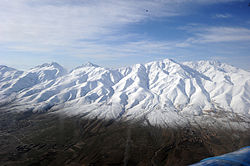
 Snow-covered mountains in Ghazni province | |
 Map of Afghanistan with Ghazni province highlighted | |
| Coordinates (Capital): 33°30′N 68°00′E / 33.5°N 68°E | |
| Country | |
| Capital | Ghazni |
| Government | |
| • Governor | Ishaq Akhundzada[1] |
| • Deputy Governor | Sayed Hanif (Ebadah Agha)[1] |
| Area | |
| • Total | 22,460 km2 (8,670 sq mi) |
| Population (2021)[2] | |
| • Total | 1,386,764 |
| • Density | 62/km2 (160/sq mi) |
| Time zone | UTC+4:30 (Afghanistan Time) |
| ISO 3166 code | AF-GHA |
| Main languages | Dari and Pashto |
Ghazni (Persian: غزنی) (Pashto: غزني) is one of the thirty-four provinces of Afghanistan. It is in the east of the country. Its capital is Ghazni City.
Demographics and geography[change | change source]
The major ethnic groups in the province are Hazaras, Pashtuns and Tajiks. There are also some Burki, and Uzbeks. Ghazni is made up of 19 districts.

| District name | District Center | Ethnical data(%)[3] |
|---|---|---|
| Ab Band | Haji Khel | 100% Pashtun |
| Ajristan | Sangar | 97% Hazara, 3% Pashtun |
| Andar | Miray | 100% Pashtun |
| Dih Yak | Ramak | 89% Pashtun, 11% Tajik |
| Gelan | Janda | 100% Pashtun |
| Ghazni | Ghazni | 50% Tajik, 25% Hazara, 25% Pashtun |
| Giro | Pana | 100% Pashtun |
| Jaghatu | Gul Bahawari | 88% Hazara, 22% Pashtun |
| Jaghori | Sange-e-Masha | 100% Hazara |
| Khogyani | Khogyani | 100% Pashtun |
| Khwaja Umari | Kwaja Umari | 45% Hazara, 35% Tajik and 20% Pashtun |
| Malistan | Malistan | 100% Hazara |
| Muqur | Muqur | 85% Pashtun, 15% Tajik |
| Nawa | Nawa | 100% Pashtun |
| Nawur | Du Abi | 100% Hazara |
| Qarabagh | Qarabagh | 50% Hazara, 40% Tajik, 10% Pashtun |
| Rashidan | Rashidan | 96% Pashtun, 4% Hazara |
| Waghaz | Waghaz | 100% Pashtun |
| Zana Khan | Dado | 100% Pashtun |
Some Sikhs and Hindus also live in Ghazni province. During the Taliban regime they fled the country. With the current administration they have returned to Ghazni city.
Infrastructure[change | change source]
Band E Sardeh Dam is located in Andar District near the border with Paktika Province. It creates a large water reservoir that is important to the irrigation of the Kahnjoor farming zone.
Related pages[change | change source]
References[change | change source]
- ↑ 1.0 1.1 "د نږدې شلو ولایاتو لپاره نوي والیان او امنیې قوماندانان وټاکل شول". November 7, 2021.
- ↑ "Estimated Population of Afghanistan 2021-22" (PDF). nsia.gov.af. National Statistic and Information Authority (NSIA). April 2021. Archived from the original (PDF) on June 24, 2021. Retrieved June 28, 2021.
- ↑ Ethnic demographic statistics taken from http://www.aims.org.af Archived 2007-09-29 at the Wayback Machine