Chesterfield

| Chesterfield | |
|---|---|
 Chesterfield Parish Church, famous for its "crooked spire" | |
 Chesterfield shown within Derbyshire | |
| Population | 104,900 (2019 estimate) |
| Demonym | Cestrefeldian |
| OS grid reference | SK382711 |
| Unitary authority |
|
| Ceremonial county | |
| Region | |
| Country | England |
| Sovereign state | United Kingdom |
| Post town | CHESTERFIELD |
| Postcode district | S40, S41 |
| Dialling code | 01246 |
| Police | Derbyshire |
| Fire | Derbyshire |
| Ambulance | East Midlands |
| UK Parliament | |
Chesterfield is a market town and borough in the county of Derbyshire in the East Midlands of England. It is on the River Rother and the River Hipper. It is Derbyshire's largest town (Derby is a city).
It is a very old town and was founded between 70–100 AD. The town received its market charter from King John in 1204.
It is 24 miles (39 km) north of Derby and 11 miles (18 km) south of Sheffield.
The town is located on the A61 between Derby and Thirsk in North Yorkshire. It is 6 miles (9.7 km) from the M1.
A 2019 census estimated that the borough has around 104,900 residents.
Chesterfield's most famous landmark is Church of St Mary and All Saints. It is famous because of its "crooked spire". The town's football club, Chesterfield F.C., are nicknamed The Spireites due to this.
Chesterfield railway station is on the Midland Main Line. Passengers can get local trains to towns and villages around the East Midlands as well as long-distance trains, operated by East Midlands Railway, to London, Sheffield and Nottingham. CrossCountry trains also stop at Chesterfield, providing passengers with direct trains to Birmingham, the North East, Scotland and Cornwall
Twin towns[change | change source]
Chesterfield is twinned with:
Gallery[change | change source]
-
 Vicar Lane
 -
 Chesterfield Market
 -
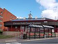 Chesterfield Coach Station
 -


| International | |
|---|---|
| National | |
| Geographic | |