Fișier:Kingdom of Sicily 1190.svg


Mărimea acestei previzualizări PNG a acestui fișier SVG: 550 × 375 pixeli. Alte rezoluții: 320 × 218 pixeli | 640 × 436 pixeli | 1.024 × 698 pixeli | 1.280 × 873 pixeli | 2.560 × 1.745 pixeli.
Mărește rezoluția imaginii (Fișier SVG, cu dimensiunea nominală de 550 × 375 pixeli, mărime fișier: 998 KB)
| Acest fișier se află la Wikimedia Commons. Consultați pagina sa descriptivă acolo. |
Descriere fișier
Această imagine vectorială a fost creată cu Inkscape .


.svg)
.svg)
.svg)
.svg)
.svg)


.svg)
.svg)
.svg)


.png)
.png)


.svg)


.svg)

.svg)


.svg)
.svg)
.svg)
.svg)


.svg)
.png)


.svg)


.svg)
.svg)


.svg)


.svg)


.svg)
.svg)
.svg)
.svg)
.svg)
.svg)
.svg)
_cropped.svg)
.svg)
.svg)
.svg)
.svg)
.svg)
.svg)
.svg)
.svg)
.svg)
.svg)
.svg)
.svg)
.svg)
.svg)
.svg)
.svg)
.svg)
.svg)
.svg)
.svg)
.svg)
.svg)
.svg)
.svg)
.svg)
.svg)
.svg)
.svg)
.svg)
.svg)
.svg)
.svg)
.svg)
.svg)
.svg)
.svg)
.svg)
.svg)
.svg)
.svg)
.svg)
.svg)
.svg)
.svg)
.svg)
Licențiere
Acest fișier a fost eliberat sub licența Creative Commons Atribuire și distribuire în condiții identice 4.0 Internațională.
- Sunteți liber:
- să partajați cu alții – aveți dreptul de a copia, distribui și transmite opera
- să adaptați – aveți dreptul de a adapta opera
- În următoarele condiții:
- atribuind – Trebuie să atribuiți opera corespunzător, introducând o legătură către licență și indicând dacă ați făcut schimbări. Puteți face asta prin orice metodă rezonabilă, dar nu într-un fel care ar sugera faptul că persoana ce a licențiat conținutul v-ar susține sau ar aproba folosirea de către dumneavoastră a operei sale.
- partajând în condiții identice – Dacă modificați, transformați sau creați pe baza acestei opere, trebuie să distribuiți opera rezultată doar sub aceeași licență sau sub o licență similară acesteia.
Istoricul fișierului
Apăsați pe Data și ora pentru a vedea versiunea trimisă atunci.
| Data și ora | Miniatură | Dimensiuni | Utilizator | Comentariu | |
|---|---|---|---|---|---|
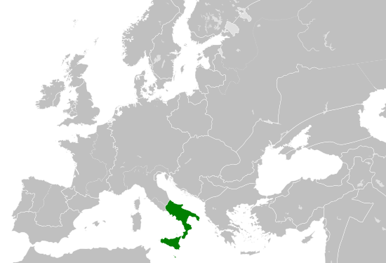
| actuală | 29 mai 2016 18:58 | | 550x375 (998 KB) | Alphathon | == {{int:filedesc}} == {{Inkscape}} {{Information |Description={{en|A map of the Norman en:Kingdom of Sicily within Europe circa 1190 CE. Note that the borders of the Cumans, Kipchaks, Kievan Rus', Kama Bulgarians and Viatka do not extend r... |
Utilizarea fișierului
Următoarele pagini conțin această imagine:
Utilizarea globală a fișierului
Următoarele alte proiecte wiki folosesc acest fișier:
- Utilizare la arz.wikipedia.org
- Utilizare la ast.wikipedia.org
- Utilizare la ca.wikipedia.org
- Utilizare la cs.wikipedia.org
- Utilizare la en.wikipedia.org
- Utilizare la eo.wikipedia.org
- Utilizare la es.wikipedia.org
- Utilizare la gl.wikipedia.org
- Utilizare la he.wikipedia.org
- Utilizare la it.wikipedia.org
- Utilizare la ja.wikipedia.org
- Utilizare la ko.wikipedia.org
- Utilizare la la.wikipedia.org
- Utilizare la lv.wikipedia.org
- Utilizare la mk.wikipedia.org
- Utilizare la pl.wikipedia.org
- Utilizare la sc.wikipedia.org
- Utilizare la simple.wikipedia.org
- Utilizare la sq.wikipedia.org
- Utilizare la th.wikipedia.org
- Utilizare la uk.wikipedia.org
- Utilizare la vi.wikipedia.org
- Utilizare la www.wikidata.org