Plik:Belarus adm location map.svg


Rozmiar pierwotny (Plik SVG, nominalnie 1626 × 1451 pikseli, rozmiar pliku: 238 KB)
| Plik Belarus adm location map.svg znajduje się w Wikimedia Commons – repozytorium wolnych zasobów. Dane z jego strony opisu znajdują się poniżej. |
Opis
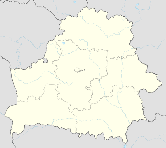
| Opis | Deutsch: Positionskarte von Weißrussland English: Location map of Belarus
| ||||||||||||
| Data | |||||||||||||
| Źródło | Praca własna przy użyciu:
| ||||||||||||
| Autor | NordNordWest | ||||||||||||
| SVG rozwój | Kod źródłowy tego poprawny. Ta mapa została stworzona za pomocą Adobe Illustrator
| ||||||||||||

Licencja
Usage of this file with:

explanatory notes: Legally binding is only the full legalcode. For a free usage I recommend to respect the following licence conditions:
1. Provide my name as given above: NordNordWest,
2. a copy of, or the URI for, the applicable license: https://creativecommons.org/licenses/by-sa/3.0/de/legalcode,
3. the title of the work,
4. in the case of an adaptation, a credit identifying the use of the work in the adaptation.
This license and the rights granted hereunder will terminate automatically upon any breach by you of the terms of this license. Any of the above conditions can be waived if you get permission from the copyright holder. If you have questions or wish differing conditions, please contact me through nnwest or my discussion page ![]() t-online.de
t-online.de
- Wolno:
- dzielić się – kopiować, rozpowszechniać, odtwarzać i wykonywać utwór
- modyfikować – tworzyć utwory zależne
- Na następujących warunkach:
- uznanie autorstwa – musisz określić autorstwo utworu, podać link do licencji, a także wskazać czy utwór został zmieniony. Możesz to zrobić w każdy rozsądny sposób, o ile nie będzie to sugerować, że licencjodawca popiera Ciebie lub Twoje użycie utworu.
- na tych samych warunkach – Jeśli zmienia się lub przekształca niniejszy utwór, lub tworzy inny na jego podstawie, można rozpowszechniać powstały w ten sposób nowy utwór tylko na podstawie tej samej lub podobnej licencji.

Historia pliku
Kliknij na datę/czas, aby zobaczyć, jak plik wyglądał w tym czasie.
| Data i czas | Miniatura | Wymiary | Użytkownik | Opis | |
|---|---|---|---|---|---|
| aktualny | 11:51, 6 maj 2016 | | 1626 × 1451 (238 KB) | NordNordWest | c |
| 18:52, 5 maj 2016 |  | 1626 × 1451 (842 KB) | NordNordWest | c | |
| 21:04, 10 wrz 2014 |  | 1626 × 1451 (249 KB) | NordNordWest | c | |
| 20:54, 10 wrz 2014 |  | 1626 × 1451 (250 KB) | NordNordWest | == {{int:filedesc}} == {{Information |Description= {{de|1=Positionskarte von Weißrussland}} {{en|1=Location map of Belarus}} {{Location map series N |top=56.4 |bottom=51.1 |left=22.9 |right=33.0 }} |Source={{Own using}} * United States National Imager... |
Lokalne wykorzystanie pliku
Z tego pliku korzysta więcej niż 100 stron. Poniższa lista pokazuje jedynie 100 pierwszych z nich. Dostępna jest również pełna lista.
- Arcisze
- Baranowicze
- Bereza
- Berezwecz
- Bernardyni
- Bobrujsk
- Borysów
- Brasław
- Brześć
- Brzostowica Mała
- Budsław
- Bychów
- Cerkiew Świętych Borysa i Gleba w Grodnie
- Chatyń
- Czaśniki
- Dawidgródek
- Domaczewo
- Dominikanie
- Drohiczyn (Białoruś)
- Dubrowa (rejon mołodecki)
- Dzierżynowo
- Dzierżyńsk (Białoruś)
- Grodno
- Hancewicze
- Holszany
- Homel
- Hrebionka
- Iwacewicze
- Kalety (Białoruś)
- Kamieniec (Białoruś)
- Katedra Świętego Franciszka Ksawerego w Grodnie
- Kleck
- Kobryń
- Korelicze
- Kościół Najświętszej Maryi Panny w Grodnie
- Kościół Znalezienia Krzyża Świętego w Grodnie
- Krewo
- Kulikowo
- Kuropaty
- Lachowicze
- Lepel
- Lida
- Lista państw świata
- Małoryta
- Mereczowszczyzna
- Miadzioł (miasto)
- Mir (osiedle typu miejskiego)
- Mińsk
- Mohylew
- Mozyrz
- Mołodeczno
- Nieśwież
- Nowogródek
- Nowopołock
- Nowołukoml
- Nowy Zamek w Grodnie
- Orsza
- Ostrowiec (obwód grodzieński)
- Oszmiana
- Oświeja
- Pińsk
- Postawy
- Połock
- Prużana
- Prypeć (rzeka)
- Przejście graniczne Połowce-Pieszczatka
- Rzeczyca (obwód homelski)
- Różana (obwód brzeski)
- Siekierzyszki
- Skidel
- Sobotniki
- Soligorsk
- Sopoćkinie
- Stare Wasiliszki
- Stary Zamek w Grodnie
- Stolin
- Stołpce
- Swietłahorsk
- Szczuczyn (Białoruś)
- Szepielewicze
- Szkłów
- Słonim
- Słuck
- Twierdza Brzeska
- Ułła
- Wasiliszki
- Wilejka (miasto)
- Wilia (dopływ Niemna)
- Wiskule
- Witebsk
- Wołczyn (obwód brzeski)
- Wołkowysk
- Zamek w Mirze
- Zamek w Nieświeżu
- Łachwa (obwód brzeski)
- Łohojsk
- Łojów
- Łuniniec
- Świsłocz (rejon świsłocki)
- Żabinka
Pokaż więcej odnośników do tego pliku.
Globalne wykorzystanie pliku
Ten plik jest wykorzystywany także w innych projektach wiki:
- Wykorzystanie na af.wikipedia.org
- Wykorzystanie na als.wikipedia.org
- Wykorzystanie na ast.wikipedia.org
- Aeropuertu de Maguilov
- Minsk
- Raión de Berazino
- Raión de Chervyen
- Raión de Dzyarzhynsk
- Raión de Kapyl
- Raión de Kletsk
- Raión de Krupki
- Raión de Lagoysk
- Raión de Maladzyechna
- Raión de Minsk
- Raión de Myadzel
- Raión de Nesvizh
- Raión de Saligorsk
- Raión de Slutsk
- Raión de Smalyavichy
- Raión de Staryadarogui
- Raión de Valozhyn
- Raión de Vileyka
- Brest (Bielorrusia)
- Gómel
- Vítebsk
- Maguilov
- Grodno
- Borísov (Minsk)
- Babruisk
- Saligorsk
- Mazyr
- Orsha
- Pinsk
- Baránavichi
- Módulu:Mapa de llocalización/datos/Bielorrusia
- Módulu:Mapa de llocalización/datos/Bielorrusia/usu
- Aeropuertu Internacional de Minsk
- Aeropuertu de Gómel
- Žodzina
- Yeshivá de Volozhin
- Volozhyn
- Mir (Bielorrusia)
- Wykorzystanie na azb.wikipedia.org
- Wykorzystanie na ban.wikipedia.org
- Wykorzystanie na be.wikipedia.org
Pokaż listę globalnego wykorzystania tego pliku.