Bestand:Pinatubo evacuation areas.gif


Grootte van deze voorvertoning: 800 × 575 pixels. Andere resoluties: 320 × 230 pixels | 640 × 460 pixels | 1.000 × 719 pixels.
Oorspronkelijk bestand (1.000 × 719 pixels, bestandsgrootte: 95 kB, MIME-type: image/gif)
| Dit is een bestand van Wikimedia Commons. Onderstaande beschrijving komt van de beschrijving van het bestand daar. |
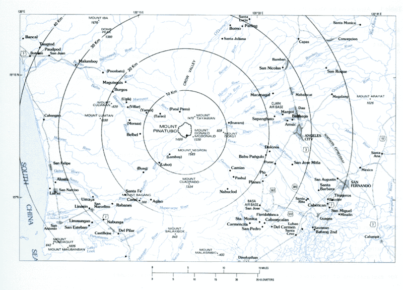
Volcanic hazard areas surrounding Mount Pinatubo.
Deze afbeelding bevindt zich in het publiek domein omdat het materiaal bevat dat oorspronkelijk afkomstig is van de United States Geological Survey, een agentschap van de United States Department of the Interior. Voor meer informatie, zie het officiële USGS-auteursrechtenbeleid
|
Bestandsgeschiedenis
Klik op een datum/tijd om het bestand te zien zoals het destijds was.
| Datum/tijd | Miniatuur | Afmetingen | Gebruiker | Opmerking | |
|---|---|---|---|---|---|
| huidige versie | 8 mrt 2006 11:59 | | 1.000 × 719 (95 kB) | Magalhães | Volcanic hazard areas surrounding Mount Pinatubo. {{PD-USGov-Interior-USGS}} Category:Mount Pinatubo |
Bestandsgebruik
Dit bestand wordt op de volgende pagina gebruikt:
Globaal bestandsgebruik
De volgende andere wiki's gebruiken dit bestand:
- Gebruikt op bg.wikipedia.org
- Gebruikt op cs.wikipedia.org
- Gebruikt op el.wikipedia.org
- Gebruikt op en.wikipedia.org
- Gebruikt op es.wikipedia.org
- Gebruikt op fr.wikipedia.org
- Gebruikt op he.wikipedia.org
- Gebruikt op pam.wikipedia.org