ファイル:Colorado census statistical areas.svg
 ウィキペディアから無料の百科事典

この SVG ファイルのこの PNG プレビューのサイズ: 800 × 580 ピクセル. その他の解像度: 320 × 232 ピクセル | 640 × 464 ピクセル | 1,024 × 742 ピクセル | 1,280 × 928 ピクセル | 2,560 × 1,856 ピクセル | 829 × 601 ピクセル。
元のファイル (SVG ファイル、829 × 601 ピクセル、ファイルサイズ: 197キロバイト)
ウィキメディア・コモンズのファイルページにある説明を、以下に表示します。 |
概要
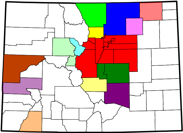
| 解説 | A county map of the United States Census Bureau statistical areas in the State of Colorado |
| 日付 | |
| 原典 | Derived from the National Atlas of the United States as converted by David Benbennick (CC) and adapted by Buaidh |
| 作者 | Buaidh |
| 許可 (ファイルの再利用) | このファイルはクリエイティブ・コモンズ 表示 2.0 一般ライセンスのもとに利用を許諾されています。
|
| その他のバージョン | File:Map_of_Colorado_counties,_blank.svg |
ライセンス
| この著作物の著作権者である私は、この著作物における権利を放棄しパブリックドメインとします。これは全世界で適用されます。 一部の国では、これが法的に可能ではない場合があります。その場合は、次のように宣言します。 私は、あらゆる人に対して、法により必要とされている条件を除き、如何なる条件も課すことなく、あらゆる目的のためにこの著作物を使用する権利を与えます。 |
ファイルの履歴
過去の版のファイルを表示するには、その版の日時をクリックしてください。
| 日付と時刻 | サムネイル | 寸法 | 利用者 | コメント | |
|---|---|---|---|---|---|
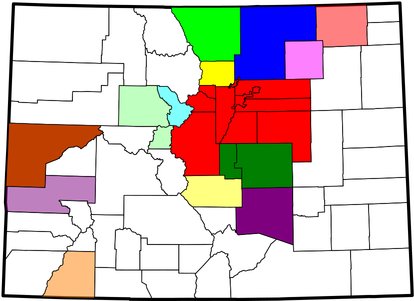
| 現在の版 | 2007年12月12日 (水) 01:22 | | 829 × 601 (197キロバイト) | Buaidh | == Summary == {{Information |Description=A county map of the Front Range Urban Corridor of Colorado and Wyoming, United States |title=Map of the Front Range Urban Corridor |Source=Derived from the National Atlas of the United States as converted by David |
| 2007年12月10日 (月) 22:28 |  | 906 × 657 (197キロバイト) | Buaidh | {{Information |Description=A county map of the United States Census Bureau statistical areas in the State of Colorado |title=Map of the Colorado census statistical Areas |Source=Derived from the National Atlas of the United States as converted by David Be |
ファイルの使用状況
以下のページがこのファイルを使用しています:
グローバルなファイル使用状況
以下に挙げる他のウィキがこの画像を使っています:
- en.wikipedia.org での使用状況