ファイル:West Lothian UK location map.svg


この SVG ファイルのこの PNG プレビューのサイズ: 526 × 600 ピクセル. その他の解像度: 210 × 240 ピクセル | 421 × 480 ピクセル | 674 × 768 ピクセル | 898 × 1,024 ピクセル | 1,796 × 2,048 ピクセル | 1,214 × 1,384 ピクセル。
元のファイル (SVG ファイル、1,214 × 1,384 ピクセル、ファイルサイズ: 983キロバイト)
ウィキメディア・コモンズのファイルページにある説明を、以下に表示します。 |
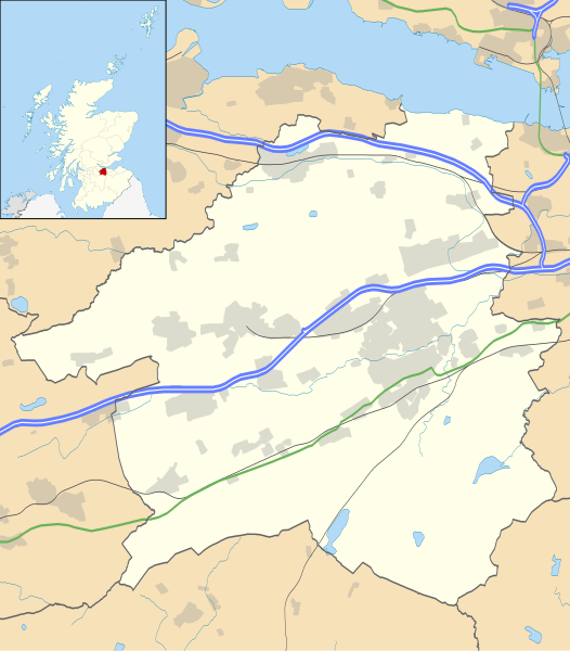
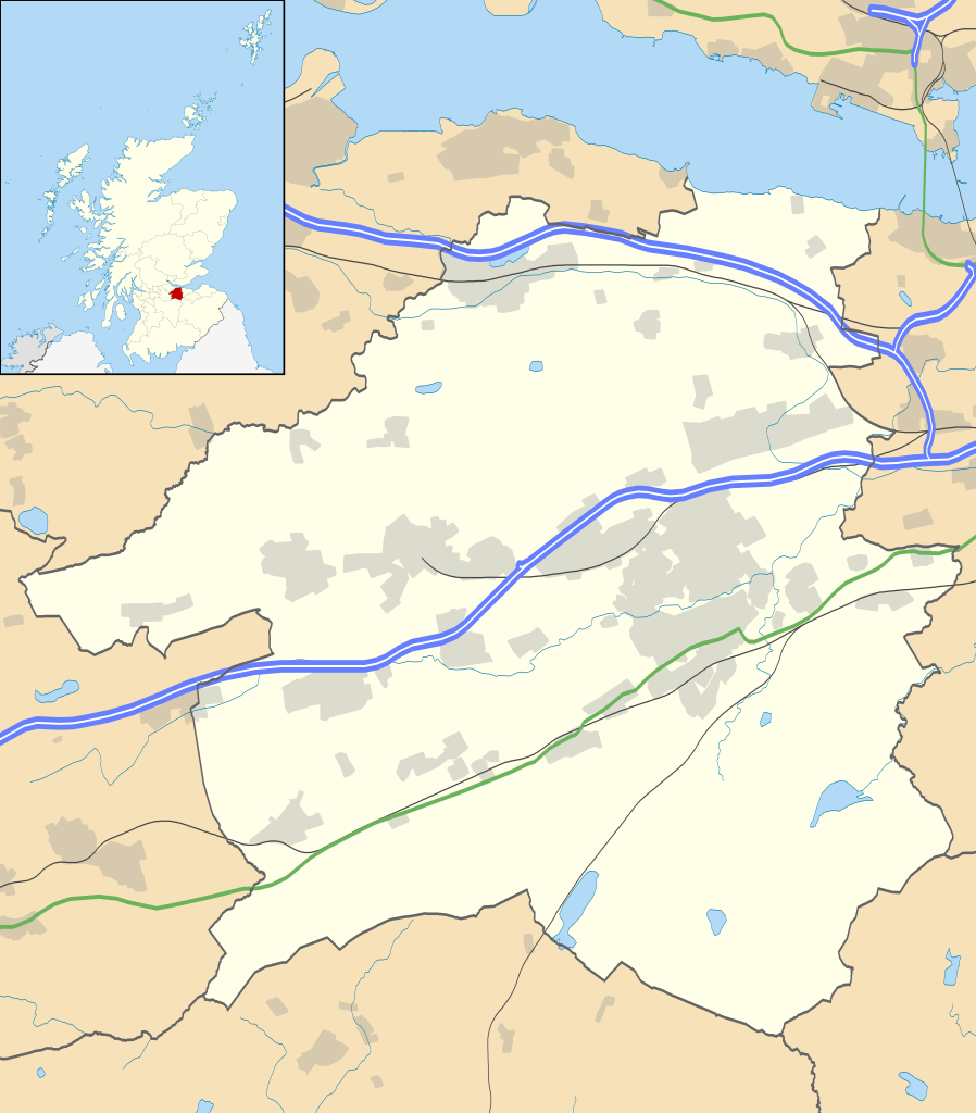
| 解説 | Blank map of West Lothian, UK with the following information shown:
Equirectangular map projection on WGS 84 datum, with N/S stretched 175% Geographic limits:
|
| 日付 | |
| 原典 |
|
| 作者 | Nilfanion, created using Ordnance Survey data |
| 許可 (ファイルの再利用) | このファイルはクリエイティブ・コモンズ 表示-継承 3.0 非移植ライセンスのもとに利用を許諾されています。 帰属: Contains Ordnance Survey data © Crown copyright and database right
|
| その他のバージョン | File:West Lothian UK blank map.svg - Blank map |
ファイルの履歴
過去の版のファイルを表示するには、その版の日時をクリックしてください。
| 日付と時刻 | サムネイル | 寸法 | 利用者 | コメント | |
|---|---|---|---|---|---|
| 現在の版 | 2010年9月26日 (日) 20:26 | | 1,214 × 1,384 (983キロバイト) | Nilfanion | {{Information |Description=Blank map of West Lothian, UK with the following information shown: *Administrative borders *Coastline, lakes and rivers *Roads and railways *Urban areas Equirectangular map projection on WGS 84 datum, with N |
ファイルの使用状況
以下の 5 ページがこのファイルを使用しています:
グローバルなファイル使用状況
以下に挙げる他のウィキがこの画像を使っています:
- ar.wikipedia.org での使用状況
- bg.wikipedia.org での使用状況
- ceb.wikipedia.org での使用状況
- de.wikipedia.org での使用状況
- en.wikipedia.org での使用状況
- List of monastic houses in Scotland
- West Lothian
- Livingston, West Lothian
- Broxburn
- Uphall
- Pumpherston
- Cairnpapple Hill
- Bathgate
- Almondvale Stadium
- Blackburn, West Lothian
- Hopetoun House
- Abercorn
- Whitburn, West Lothian
- Fauldhouse
- Livingston Village
- Addiewell
- Harthill, Scotland
- Armadale, West Lothian
- Seafield, West Lothian
- Winchburgh
- Mid Calder
- Stoneyburn
- Scottish Junior Football East Region Premier League South
- West Calder
- Linlithgow
- Castle Greg
- Philpstoun
- Deans, West Lothian
- Uphall Station
- Torphichen
- Dechmont
- Polbeth
- East Calder
- Kirknewton, West Lothian
- Blackridge, West Lothian
- Breich
- Bangour Village Hospital
- Westfield, West Lothian
- Bellsquarry
- Bathville
- Boghall
- Burnwynd
- Kingscavil
- Ecclesmachan
- Craigshill
このファイルのグローバル使用状況を表示する。