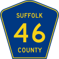
ファイル:Suffolk County 46.svg


元のファイル (SVG ファイル、451 × 451 ピクセル、ファイルサイズ: 12キロバイト)
ファイルの履歴
過去の版のファイルを表示するには、その版の日時をクリックしてください。
| 日付と時刻 | サムネイル | 寸法 | 利用者 | コメント | |
|---|---|---|---|---|---|
| 現在の版 | 2012年3月26日 (月) 02:30 |  | 451 × 451 (12キロバイト) | TwinsMetsFan | |
| 2006年8月1日 (火) 23:29 |  | 450 × 450 (17キロバイト) | TwinsMetsFan | {{Information |Description=Suffolk County Route 46 shield. Public domain. |Source=Based on Image:Middlesex County Route 676 NJ.svg by Northenglish, licensed in the Public Domain. "Suffolk" county name and "46" applied by [[w:U |
ファイルの使用状況
以下の 2 ページがこのファイルを使用しています:
グローバルなファイル使用状況
以下に挙げる他のウィキがこの画像を使っています:
- en.wikipedia.org での使用状況
- Long Island
- Brookhaven, New York
- List of highways numbered 46
- Parkways in New York
- List of county routes in Suffolk County, New York
- County Route 46 (Suffolk County, New York)
- Transportation on Long Island
- List of county routes in Suffolk County, New York (26–50C)
- Wikipedia:WikiProject U.S. Roads/Redirects/New York/County list
- User:Bramwellelijah7/Test
- ru.wikipedia.org での使用状況
