ファイル:Roman Empire 125.png

元のファイル(2,186 × 1,817 ピクセル、ファイルサイズ: 4.43メガバイト、MIME タイプ: image/png)

カメラの位置45° 00′ 00″ 北, 20° 00′ 00″ 東 Kartographer map based on OpenStreetMap.以下のサービスでこの位置を確認する: オープンストリートマップinfo

概要

解説
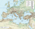
English: Map of the Roman Empire in 125 during the reign of emperor Hadrian, with anachronistic Germanic tribes from the time of Augustus.

Projection

Lambert azimuthal-equal area. Central latitude: 45° N, central longitude: 20° E. X, Y origin offset - 0

Datum: ETRS89

Sources

The physical map was made using the following public domain sources:

Additional references for the map content:

  • Tacitus, Germania (ca. 100)
  • Ptolemy, Geographia (ca. 140)
  • Atlante storico DeAgostini, Instituto Geografico DeAgostini, 1998. pg. 35-41.
  • Historischer Weltatlas, Dr. Walter Leisering, Marix Verlag, 2011. pg. 26-27
  • Történelmi világatlasz, Cartographia Kiadó, 2005. pg. 20-21.
  • The Penguin Historical Atlas of Ancient Rome by Christopher Scarre, Penguin Historical Atlases, 1995. pg. 81.

Software used

GIS:

Graphics editors:

日付
原典 投稿者自身による著作物
作者
許可
(ファイルの再利用)
Any use of this map can be made as long as you credit the author, Andrei N. (Wikipedia Commons user Andrein), and distribute the copies and derivative works under the same license as that the one stated below.
その他のバージョン [編集]
このファイルのベクター画像 (SVG) が利用できます。 使う目的に対し、元画像よりもSVGがより優れている場合、SVG画像を使用して下さい。

File:Roman Empire 125.png → File:Roman Empire 125.svg

ベクターグラフィックスの詳細については、コモンズのSVG変換を参照ください。
SVGのMediaWikiのサポートに関する情報もあります。

他言語
Alemannisch  Bahasa Indonesia  Bahasa Melayu  British English  català  čeština  dansk  Deutsch  eesti  English  español  Esperanto  euskara  français  Frysk  galego  hrvatski  Ido  italiano  lietuvių  magyar  Nederlands  norsk bokmål  norsk nynorsk  occitan  Plattdüütsch  polski  português  português do Brasil  română  Scots  sicilianu  slovenčina  slovenščina  suomi  svenska  Tiếng Việt  Türkçe  vèneto  Ελληνικά  беларуская (тарашкевіца)  български  македонски  нохчийн  русский  српски / srpski  татарча/tatarça  українська  ქართული  հայերեն  বাংলা  தமிழ்  മലയാളം  ไทย  한국어  日本語  简体中文  繁體中文  עברית  العربية  فارسی  +/−
新しいSVG画像

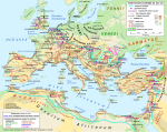
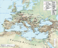
General map
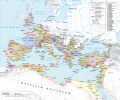
Political map

ライセンス

この作品の著作権者である私は、この作品を以下のライセンスで提供します。
w:ja:クリエイティブ・コモンズ
表示 継承
このファイルはクリエイティブ・コモンズ 表示-継承 3.0 非移植ライセンスのもとに利用を許諾されています。
あなたは以下の条件に従う場合に限り、自由に
  • 共有 – 本作品を複製、頒布、展示、実演できます。
  • 再構成 – 二次的著作物を作成できます。
あなたの従うべき条件は以下の通りです。
  • 表示 – あなたは適切なクレジットを表示し、ライセンスへのリンクを提供し、変更があったらその旨を示さなければなりません。これらは合理的であればどのような方法で行っても構いませんが、許諾者があなたやあなたの利用行為を支持していると示唆するような方法は除きます。
  • 継承 – もしあなたがこの作品をリミックスしたり、改変したり、加工した場合には、あなたはあなたの貢献部分を元の作品とこれと同一または互換性があるライセンスの下に頒布しなければなりません。
GNU head この文書は、フリーソフトウェア財団発行のGNUフリー文書利用許諾書 (GNU Free Documentation License) 1.2またはそれ以降のバージョンの規約に基づき、複製や再配布、改変が許可されます。不可変更部分、表紙、背表紙はありません。このライセンスの複製は、GNUフリー文書利用許諾書という章に含まれています。
あなたは上記のライセンスから、どれか一つ以上を選択できます。
Maps of the history of Europe
BCE
aC

Weichselian ice age (c. 113,000–9700) · Neolithic expansion (c. 7000–4500) · Middle Neolithic (c. 4500–4000) · Late Neolithic (c. 4000–3000) · Copper Age – Corded Ware culture (c. 2900–2350) · Copper Age – Bellbeaker culture (c. 2800–1800) · Early Bronze Age – Unetice culture (c. 2300–1600) · Late Bronze Age – Urnfield culture (c. 1300—750) · Migrations (c. 1000–100) · Hallstatt & La Tène cultures (c. 800–100) · Roman Republic (510–40) · 220 · 218 · 200 · 201–100 · 58 · 49 · 39 · 30 BCE–6 CE


CE
dC

14 · 14–37 · 60 · 60 · 69 · 80 · Migrations 100–500 · 117 · 117 · 125 · Migrations 150–774 · Economy 180 · 271 · 293–305 · 337 · 395 · c. 395 · 400 · 400 · 450 · 457–61 · 476 · 480 · Franks 481–814 · Early Slavs 500–700 · 500 · 526 · 526–600 · Christianisation to 600 · c. 550 · 650 · Pontic Steppe 650 · 665 · 800 · Vikings 800–1050 · 814 · 843–70 · 850 · 900 · 912 · 998 · 1000 · 1000 · 1054 · 1092 · First Crusade 1095–99 · 1097 · 1135 · 1142 · 1147–49 · 1190 · 1190 · 1250 · c. 1250 · 1301-1400 · 1301-1400 · 1328 · 1345 · Black Plague 1347–51 · 1360 · 1400 · Trade routes c. 1400 · 1430 · 1470 · 1490 · 1492 · 1500 · 1519 · 1550 · 1560 · Religion 1560 · Religion 1600 · Religion 1618 · 1618–48 · 1648 · 1683 · 1700 · 1701 · 1708 · 1714 · 1721 · 1725–30 · 1739–1740 · 1740 · 1748–66 · 1783–1792 · 1787 · 1787 · 1789 · 1799 · 1812 · 1812 · 1812 · 1812 · 1813 · 1815 · 1815 · 1815 · 1818 · Ottoman Empire 1830–1923 · 1848–49 · 1861 · 1867 · 1871 · 1878 · 1890 · 1905 · 1911 · 1914 · 1914 · 1919 · 1919–29 · 1923 · 1929 · 1930 · 1940 · 1941–42 · 1942–45 · Cold War 1947–91 · 1950 · 1993–2006 · 2006 to date

(this template: · view · discuss )

キャプション

このファイルの内容を1行で記述してください
The Roman empire under Hadrian (ruled 117–138) showing the location of roads, cities, provincial boundaries, naval bases, the Roman legions deployed in 125 AD and Germanic tribes from the time of Augustus

このファイルに描写されている項目

題材

5月 2013

45°0'0.000"N, 20°0'0.000"E

ファイルの履歴

過去の版のファイルを表示するには、その版の日時をクリックしてください。

(最新 | 最古) (以後の10件 | ) (10 | 20 | 50 | 100 | 250 | 500 件) を表示
日付と時刻サムネイル寸法利用者コメント
現在の版2019年1月12日 (土) 19:342019年1月12日 (土) 19:34時点における版のサムネイル2,186 × 1,817 (4.43メガバイト)ArdadNThis purpose of this map is not to represent ancient shorelines. Please upload a separate file with your original contributions!
2018年9月17日 (月) 16:182018年9月17日 (月) 16:18時点における版のサムネイル2,186 × 1,817 (4.37メガバイト)Julieta39Shorelines of the time (Westermann Grosser Atlas zur Weltgeschichte, Braunschweig 1985, p. 36, 38, 39, ISBN 3-14-10-0919-8 and Andrein' s [https://commons.wikimedia.org/wiki/File:Danube_Delta_evolution.gif] since L. Giosan).
2015年7月20日 (月) 18:162015年7月20日 (月) 18:16時点における版のサムネイル2,186 × 1,817 (4.43メガバイト)ArdadN1
2015年7月20日 (月) 17:492015年7月20日 (月) 17:49時点における版のサムネイル2,186 × 1,817 (4.43メガバイト)ArdadN1
2015年3月3日 (火) 18:472015年3月3日 (火) 18:47時点における版のサムネイル2,186 × 1,817 (4.43メガバイト)ArdadNfixing text problems
2015年3月3日 (火) 17:062015年3月3日 (火) 17:06時点における版のサムネイル2,186 × 1,817 (4.38メガバイト)ArdadNnew road added
2015年2月10日 (火) 13:262015年2月10日 (火) 13:26時点における版のサムネイル2,186 × 1,817 (4.43メガバイト)ArdadN1
2014年5月20日 (火) 18:452014年5月20日 (火) 18:45時点における版のサムネイル2,186 × 1,817 (4.43メガバイト)ArdadN1
2014年4月9日 (水) 18:202014年4月9日 (水) 18:20時点における版のサムネイル2,186 × 1,817 (4.43メガバイト)ArdadNScotti
2014年3月30日 (日) 15:392014年3月30日 (日) 15:39時点における版のサムネイル2,186 × 1,817 (4.43メガバイト)ArdadN1
(最新 | 最古) (以後の10件 | ) (10 | 20 | 50 | 100 | 250 | 500 件) を表示

グローバルなファイル使用状況

以下に挙げる他のウィキがこの画像を使っています:

このファイルのグローバル使用状況を表示する。

メタデータ