ファイル:Lorain Ohio aerial view.jpg


このプレビューのサイズ: 800 × 534 ピクセル。 その他の解像度: 320 × 214 ピクセル | 640 × 427 ピクセル | 1,024 × 683 ピクセル | 1,500 × 1,001 ピクセル。
元のファイル (1,500 × 1,001 ピクセル、ファイルサイズ: 567キロバイト、MIME タイプ: image/jpeg)
ウィキメディア・コモンズのファイルページにある説明を、以下に表示します。 |
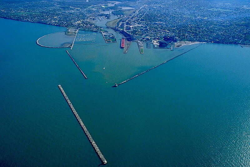
| 解説 | English: Aerial view of the harbor at Lorain, Ohio, USA. The Black River flows into Lake Erie in Lorain. The view is to the southeast. The U.S. Army Corps of Engineers built the breakwaters for this commercial harbor and built a confined disposal facility (CDF) for storing polluted material from dredging operations. Also constructed a small boat harbor breakwall. | |||
| 日付 | ||||
| 原典 | U.S. Army Corps of Engineers Digital Visual Library Image page Image description page Digital Visual Library home page | |||
| 作者 | Ken Winters, U.S. Army Corps of Engineers | |||
| 許可 (ファイルの再利用) |
| |||
| 場所 | Lorain, Ohio, USA |
| カメラの位置 | | 以下のサービスでこの位置を確認する: オープンストリートマップ |
|---|
ファイルの履歴
過去の版のファイルを表示するには、その版の日時をクリックしてください。
| 日付と時刻 | サムネイル | 寸法 | 利用者 | コメント | |
|---|---|---|---|---|---|
| 現在の版 | 2007年3月24日 (土) 22:14 | | 1,500 × 1,001 (567キロバイト) | DanMS | {{Information | Description = {{en|Aerial view of the harbor at Lorain, Ohio, USA. The Black River flows into Lake Erie in Lorain. The view is to the southeast. The U.S. Army Corps of Engineers built the breakwaters for this commercial harbor and buil |
ファイルの使用状況
以下のページがこのファイルを使用しています:
グローバルなファイル使用状況
以下に挙げる他のウィキがこの画像を使っています:
- de.wikipedia.org での使用状況
- en.wikipedia.org での使用状況
- fa.wikipedia.org での使用状況
- fr.wikipedia.org での使用状況
- it.wikipedia.org での使用状況
- sh.wikipedia.org での使用状況
- www.wikidata.org での使用状況