Fichier:Indianapolis.svg


Fichier d’origine (Fichier SVG, nominalement de 1 624 × 1 548 pixels, taille : 723 kio)
Ce fichier et sa description proviennent de Wikimedia Commons.
| Cette œuvre a été placée dans le domaine public par son auteur, SPUI. Ceci s’applique dans le monde entier. Dans certains pays, ceci peut ne pas être possible ; dans ce cas : |
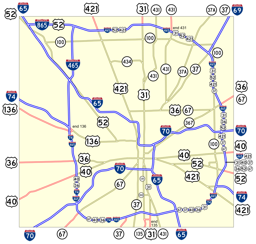
Map of numbered routes in Indianapolis, Indiana. Traced on USGS topos. Information is from the maps and photos on [1].
- Blue: Interstate
- Red: Current route
- Yellow: Former route
If you need a thumbnail use Image:Indianapolis.png.
An alternate version at Image:Indianapolis numbered routes labeled.svg shows street names.
Historique du fichier
Cliquer sur une date et heure pour voir le fichier tel qu'il était à ce moment-là.
| Date et heure | Vignette | Dimensions | Utilisateur | Commentaire | |
|---|---|---|---|---|---|
| actuel | 4 juin 2006 à 19:27 | | 1 624 × 1 548 (723 kio) | SPUI~commonswiki | {{spuimap}} Map of numbered routes in Indianapolis, Indiana. Traced on USGS topos. Information is from the maps and photos on [http://illi-indi.com/IndianaHighwayList.php]. *Blue: Interstate *Red: Current route *Yellow: Former route If you need a thumbnai |
Utilisation du fichier
La page suivante utilise ce fichier :
Usage global du fichier
Les autres wikis suivants utilisent ce fichier :
- Utilisation sur en.wikipedia.org
- Utilisation sur fi.wikipedia.org
- Utilisation sur ja.wikipedia.org
- Utilisation sur nl.wikipedia.org
- Utilisation sur simple.wikipedia.org
- Utilisation sur www.wikidata.org
- Utilisation sur zh.wikipedia.org