Fichier:Åland location map.svg


Taille de cet aperçu PNG pour ce fichier SVG : 595 × 600 pixels. Autres résolutions : 238 × 240 pixels | 476 × 480 pixels | 762 × 768 pixels | 1 016 × 1 024 pixels | 2 032 × 2 048 pixels | 996 × 1 004 pixels.
Fichier d’origine (Fichier SVG, nominalement de 996 × 1 004 pixels, taille : 185 kio)
Ce fichier et sa description proviennent de Wikimedia Commons.
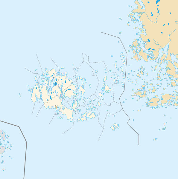
| Description | Deutsch: Positionskarte der Åland Quadratische Plattkarte, N-S-Streckung 100 %, Geographische Begrenzung der Karte: * N: 61.0° N * S: 59.5° N * W: 19.0° O * O: 22.0° O Français : Carte de géolocalisation de l'État libre associé d'Åland en projection équirectangulaire, coordonnées extrêmes de la carte: * N: 61.0° N * S: 59.5° N * W: 19.0° E * O: 22.0° E |
| Date | (UTC) |
| Source | |
| Auteur |
|
| Cette image a été retouchée, ce qui signifie qu'elle a été modifiée par ordinateur et est différente de l'image d'origine. L'image d'origine se trouve ici : Åland Political Map-blank.svg:
|
Moi, en tant que détenteur des droits d’auteur sur cette œuvre, je la publie sous les licences suivantes :
Ce fichier est sous licence Creative Commons Attribution – Partage dans les Mêmes Conditions 3.0 (non transposée), 2.5 Générique, 2.0 Générique et 1.0 Générique.
- Vous êtes libre :
- de partager – de copier, distribuer et transmettre cette œuvre
- d’adapter – de modifier cette œuvre
- Sous les conditions suivantes :
- paternité – Vous devez donner les informations appropriées concernant l'auteur, fournir un lien vers la licence et indiquer si des modifications ont été faites. Vous pouvez faire cela par tout moyen raisonnable, mais en aucune façon suggérant que l’auteur vous soutient ou approuve l’utilisation que vous en faites.
- partage à l’identique – Si vous modifiez, transformez, ou vous basez sur cette œuvre, vous devez distribuer votre contribution sous la même licence ou une licence compatible avec celle de l’original.
 | Vous avez la permission de copier, distribuer et modifier ce document selon les termes de la GNU Free Documentation License version 1.2 ou toute version ultérieure publiée par la Free Software Foundation, sans sections inaltérables, sans texte de première page de couverture et sans texte de dernière page de couverture. Un exemplaire de la licence est inclus dans la section intitulée GNU Free Documentation License. |
Vous pouvez choisir l’une de ces licences.
Journal des téléversements d’origine
This image is a derivative work of the following images:
- File:Åland_Political_Map-blank.svg licensed with Cc-by-sa-3.0,2.5,2.0,1.0, GFDL
- 2007-08-21T16:27:02Z Sémhur 996x1004 (200777 Bytes) {{Information |Description= {{en|Political blank map of the autonomous finnish province of [[:en:Åland|Åland]]. Shows the national, regional and municipal boundaries about Åland islands.}} {{fr|Carte politique de l'État l
Téléversé avec derivativeFX
Historique du fichier
Cliquer sur une date et heure pour voir le fichier tel qu'il était à ce moment-là.
| Date et heure | Vignette | Dimensions | Utilisateur | Commentaire | |
|---|---|---|---|---|---|
| actuel | 23 juillet 2010 à 15:14 | | 996 × 1 004 (185 kio) | Xfigpower | {{Information |Description={{de|1=Positionskarte der Åland Quadratische Plattkarte, N-S-Streckung 100 %, Geographische Begrenzung der Karte: * N: ???° N * S: ???° N * W: ???° W * O: ???° W}} {{en|1=Carte de géolocalisation de l'État |
Utilisation du fichier
Les 2 pages suivantes utilisent ce fichier :
Usage global du fichier
Les autres wikis suivants utilisent ce fichier :
- Utilisation sur an.wikipedia.org
- Utilisation sur ar.wikipedia.org
- Utilisation sur ceb.wikipedia.org
- Plantilya:Location map Finland Åland Islands
- Plantilya:Location map Aland Islands
- Stenskär
- Nygrund
- Stenskar
- Kalkgrund
- Ekholm
- Lango
- Vro
- Kalen
- Platen
- Basto
- Sando
- Pungo
- Geto
- Nato
- Valo
- Skaret
- Granholm
- Grano
- Kalvholmen
- Haren
- Skarven
- Baro
- Hogan
- Adoe
- Kakan
- Lagan
- Badan
- Hundskar
- Kasberg
- Gollan
- Stora Lökskär
- Gadden
- Yxskär
- Bredan
- Ytterskär
- Ytterön
- Ytteroen
- Ytterö
- Långskär
- Vitklobbarna
- Vitfågelskär
- Viggskär
- Vikskär
- Vikarskären
- Storlandet
- Vidskär
Voir davantage sur l’utilisation globale de ce fichier.