پرونده:1800 Wilkinson Map of the 4 Eastern Churches rectified.jpg


پروندهٔ اصلی (۱٬۶۷۸ × ۱٬۳۰۸ پیکسل، اندازهٔ پرونده: ۸۹۵ کیلوبایت، نوع MIME پرونده: image/jpeg)
این پرونده در ویکیانبار موجود است. محتویات صفحهٔ توصیف آن در زیر نمایش داده میشود. |
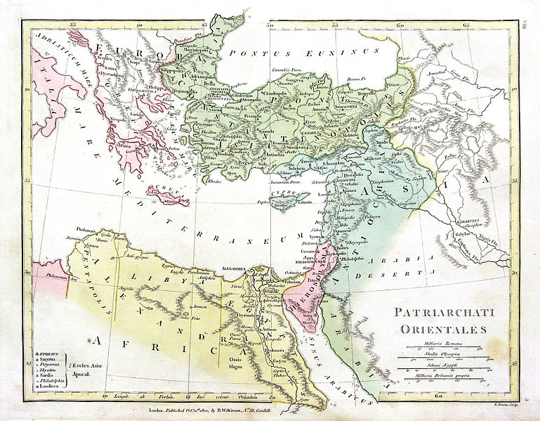
| توضیح | English: Map of the 4 Eastern Churches in the Pentarchy, circa 500CE |
| تاریخ | (UTC) |
| منبع | |
| پدیدآور | The original uploader was Fredrick Wilhelm در ویکیپدیا انگلیسی.
|
| این یک عکس دستکاری شده است به این معنی که به صورت دیجیتالی از نسخهٔ اصلی تغییر یافتهاست. تغییرها: Rectified, cropped, colors corrected. اصل آن را میتوان در اینجا مشاهده کرد: 1800 Wilkinson Map of the 4 Eastern Churches.jpg. تغییرها توسط MichaelBueker انجام شدهاست.
|
| این اثر در کشورهایی و مناطقی که مدت زمان حق تکثیر، عمر پدیدآورنده بعلاوه 70 سال یا کمتر بعد از مرگ او است، در مالکیت عمومی قرار دارد.
| |
| این پرونده تحت قانون حق تکثیر محدودیت آزاد منتشر شده که شامل تمامی حقوق مربوطه و حقوق نزدیک به آن میشود. | |
سیاهه بارگذاری اصلی
This image is a derivative work of the following images:
- File:1800_Wilkinson_Map_of_the_4_Eastern_Churches.jpg licensed with Cc-pd-mark-footer, PD-old
- 2010-08-24T08:50:03Z File Upload Bot (Magnus Manske) 1802x1378 (2039705 Bytes) {{BotMoveToCommons|en.wikipedia|year={{subst:CURRENTYEAR}}|month={{subst:CURRENTMONTHNAME}}|day={{subst:CURRENTDAY}}}} {{Information |Description={{en|Map of the 4 Eastern Churches in the Pentarchy, circa 500CE}} |Source=Tra
Uploaded with derivativeFX
تاریخچهٔ پرونده
روی تاریخ/زمانها کلیک کنید تا نسخهٔ مربوط به آن هنگام را ببینید.
| تاریخ/زمان | بندانگشتی | ابعاد | کاربر | توضیح | |
|---|---|---|---|---|---|
| کنونی | ۱۰ فوریهٔ ۲۰۱۶، ساعت ۲۰:۴۷ | | ۱٬۶۷۸ در ۱٬۳۰۸ (۸۹۵ کیلوبایت) | Чръный человек | обработка |
| ۹ فوریهٔ ۲۰۱۶، ساعت ۱۸:۰۴ |  | ۱٬۶۷۸ در ۱٬۳۰۸ (۱٫۲۲ مگابایت) | Чръный человек | Осветление | |
| ۱ مهٔ ۲۰۱۱، ساعت ۲۰:۲۹ |  | ۱٬۶۷۸ در ۱٬۳۰۸ (۱٫۹۱ مگابایت) | MichaelBueker | color touchup | |
| ۱ مهٔ ۲۰۱۱، ساعت ۲۰:۱۴ |  | ۱٬۶۷۸ در ۱٬۳۰۸ (۱٫۶۱ مگابایت) | MichaelBueker | {{Information |Description={{en|Map of the 4 Eastern Churches in the Pentarchy, circa 500CE}} |Source=*File:1800_Wilkinson_Map_of_the_4_Eastern_Churches.jpg |Date=2011-05-01 20:13 (UTC) |Author=*[[:File:1800_Wilkinson_Map_of_the_4_Eastern_Churches.j |
کاربرد پرونده
صفحهٔ زیر از این تصویر استفاده میکند:
کاربرد سراسری پرونده
ویکیهای دیگر زیر از این پرونده استفاده میکنند:
- کاربرد در ar.wikipedia.org
- کاربرد در arz.wikipedia.org
- کاربرد در az.wikipedia.org
- کاربرد در bg.wikipedia.org
- کاربرد در bn.wikipedia.org
- کاربرد در ckb.wikipedia.org
- کاربرد در cs.wikipedia.org
- کاربرد در el.wikipedia.org
- کاربرد در en.wikipedia.org
- کاربرد در eo.wikipedia.org
- کاربرد در es.wikipedia.org
- کاربرد در fr.wikipedia.org
- کاربرد در hu.wikipedia.org
- کاربرد در id.wikipedia.org
- کاربرد در it.wikipedia.org
- کاربرد در ko.wikipedia.org
- کاربرد در mk.wikipedia.org
- کاربرد در ml.wikipedia.org
- کاربرد در pt.wikipedia.org
- کاربرد در ru.wikipedia.org
- کاربرد در sk.wikipedia.org
- کاربرد در sr.wikipedia.org
- کاربرد در sv.wikipedia.org
- کاربرد در tr.wikipedia.org
- کاربرد در uk.wikipedia.org
- کاربرد در zh-min-nan.wikipedia.org
نمایش استفادههای سراسری از این پرونده.