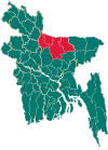
Sreebardi Upazila
 From Wikipedia the free encyclopedia
Sreebardi শ্রীবরদী | |
|---|---|
 | |
| Coordinates: 25°9′N 89°54.2′E / 25.150°N 89.9033°E | |
| Country | |
| Division | Mymensingh Division |
| District | Sherpur District |
| Area | |
| • Total | 248.25 km2 (95.85 sq mi) |
| Population (2011) | |
| • Total | 259,648 |
| • Density | 1,000/km2 (2,700/sq mi) |
| Time zone | UTC+6 (BST) |
| Website | sreebordi |
Sreebardi (Bengali: শ্রীবরদী) is an upazila of Sherpur District[1] in the Division of Mymensingh, Bangladesh.
Geography[edit]
Sreebardi is located at 25°09′00″N 89°54′10″E / 25.1500°N 89.9028°E. It has 65,892 households and total area 248.25 km2. It is bounded by Meghalaya state of India on the north, Sherpur sadar upazila on the south, Jhenaigati upazila on the east, Bakshiganj and Islampur upazila on the west.[1]
Demographics[edit]
According to the 2011 Bangladesh census, Sreebardi Upazila had 65,892 households and a population of 259,648. 67,575 (26.03%) were under 10 years of age. Sreebardi has a literacy rate (age 7 and over) of 34.8%, compared to the national average of 51.8%, and a sex ratio of 1014 females per 1000 males. 24,169 (9.31%) lived in urban areas. Ethnic population is 2,117 (0.82%), half of whom are Garo.[2][3]
According to the 2001 Bangladesh census, Sreebardi had a population of 242320; males constituted 125039, females 117281; Muslim 237863, Hindu 3283, Christian 1141 and others 33.
As of the 1991 Bangladesh census, the upazila had a population of 228194. Males constituted 50.88% of the population, and females 49.12%. This Upazila's eighteen up population was 109693. Sreebardi had an average literacy rate of 18.5% (7+ years), and the national average of 32.4% literate.[4]
Administration[edit]
Sreebardi Thana, now an upazila, was formed on 31 March 1918. Sreebardi Municipality was formed in 24 September 2004.[1]
The Upazila is divided into Sreebardi Municipality and ten union parishads: Bhelua, Garjaripa, Gosaipur, Kakilakura, Kharia Kazirchar, Kurikahonia, Ranishimul, Singabaruna, Sreebordi, and Tatihati. The union parishads are subdivided into 81 mauzas and 142 villages.[5]
Sreebardi Municipality is subdivided into 9 wards and 20 mahallas.[5]
See also[edit]
References[edit]
- ^ a b c Syed Marufuzzaman (2012), "Sreebardi Upazila", in Sirajul Islam and Ahmed A. Jamal (ed.), Banglapedia: National Encyclopedia of Bangladesh (Second ed.), Asiatic Society of Bangladesh
- ^ a b "Community Tables: Sherpur district" (PDF). bbs.gov.bd. 2011.
- ^ "Bangladesh Population and Housing Census 2011 Zila Report – Sherpur" (PDF). bbs.gov.bd. Bangladesh Bureau of Statistics.
- ^ "Population Census Wing, BBS". Archived from the original on 2005-03-27. Retrieved November 10, 2006.
- ^ a b "District Statistics 2011: Sherpur" (PDF). Bangladesh Bureau of Statistics. Archived from the original (PDF) on 13 November 2014. Retrieved 14 July 2014.
