Mwogo River
 From Wikipedia the free encyclopedia
| Mwogo River | |
|---|---|
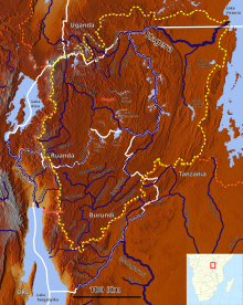
 Mwogo River in the Kagera catchment (center left) | |
| Location | |
| Country | Rwanda |
| Physical characteristics | |
| Mouth | |
• coordinates | 2°12′31″S 29°33′42″E / 2.208477°S 29.561634°E |
| Basin features | |
| River system | Nyabarongo River |
| Tributaries | |
| • left | Rukarara River, Mbirurume River |
The Mwogo River is a river in western Rwanda that is a tributary of the Nyabarongo River.
Course[edit]
The Mwogo rises in forested country in southern Rwanda to the east of the Congo-Nile Divide.[1] It has its sources in the Kitabi sector of the Nyamagabe District. It runs eastward past Nyarusiza into the Huye District.[2] It runs in a northeast direction through the western part of this district, entering the Nyanza district.[3] In Nyanza district it runs northeast, passing Mweya at the point where the Gihimbi River enters it from the left.[4] Below this point it is joined by the Rukarara River from the left.[2] It then forms the western boundary of Ruhango District until it is joined from the left by the Mbirurume River just south of Bwakira. The combined stream is called the Nyabarongo River, which continues northward.[5][a]
Hydrology[edit]
The Mwogo is one of the main headwaters of the Nyawarungu river.[1] Measurements of precipitation and evaporation at the Nyabisindu station show that the Mwogo river basin produces an average annual water flow of 252 millimetres (9.9 in).[8] In parts of the river valley the hills have been cleared of hills, causing erosion and silting problems. Efforts are being made to replant trees.[9] The Mwogo and Rukarara provide is the main source of water for the town of Nyanza.[10]
References[edit]
Notes
Citations
- ^ a b Hughes, Hughes & Bernacsek 1992, p. 201.
- ^ a b Nyamagabe Administrative Map.
- ^ Huye Administrative Map.
- ^ Nyanza Administrative Map.
- ^ Ruhango Administrative Map.
- ^ Briggs & Booth 2010, p. 154.
- ^ Osborne 2012, p. 206.
- ^ Kanyarukiga & Ngarambe 1998.
- ^ Rusumo hydroelectric power...
- ^ Rwanda Mission Report, p. 28.
Sources
- Briggs, Philip; Booth, Janice (2010-03-16). Rwanda. Bradt Travel Guides. p. 154. ISBN 978-1-84162-306-1. Retrieved 2013-04-03.
- Hughes, Ralph H.; Hughes, Jane S.; Bernacsek, G. M. (1992). Iucn Directory of African Wetlands. IUCN. ISBN 978-2-88032-949-5. Retrieved 2013-03-25.
- "Huye Administrative Map". National Institute of Statistics of Rwanda. Archived from District.pdf the original (PDF) on 2017-02-20. Retrieved 2013-04-02.
{{cite web}}: Check|url=value (help) - Kanyarukiga, Sam G.; Ngarambe, Vincent (1998). "The agricultural characterization and the classification of wetlands of Eastern and Southern Africa". FAO. Retrieved 2013-04-04.
- "Nyamagabe Administrative Map". National Institute of Statistics of Rwanda. Archived from District.pdf the original (PDF) on 2017-02-20. Retrieved 2013-04-02.
{{cite web}}: Check|url=value (help) - "Nyanza Administrative Map". National Institute of Statistics of Rwanda. Archived from District.pdf the original (PDF) on 2017-02-20. Retrieved 2013-04-02.
{{cite web}}: Check|url=value (help) - Osborne, Patrick L. (2012-02-09). Tropical Ecosystems and Ecological Concepts. Cambridge University Press. ISBN 978-0-521-17734-4. Retrieved 2013-04-04.
- "Ruhango Administrative Map". National Institute of Statistics of Rwanda. Archived from District.pdf the original (PDF) on 2017-02-20. Retrieved 2013-04-02.
{{cite web}}: Check|url=value (help) - "Rusumo hydroelectric power project to start". 25 February 2008. Archived from the original on 3 March 2016. Retrieved 2013-04-04.
{{cite journal}}: Cite journal requires|journal=(help) - "Rwanda Mission Report" (PDF). UN-HABITAT. November 2007. Retrieved 2013-04-04.