File:WA-504 St. Helens Bridge after 1980 eruption.jpg
 From Wikipedia the free encyclopedia
Size of this preview: 800 × 527 pixels. Other resolutions: 320 × 211 pixels | 640 × 421 pixels | 1,024 × 674 pixels | 1,280 × 842 pixels | 2,560 × 1,685 pixels | 5,643 × 3,714 pixels.
Original file (5,643 × 3,714 pixels, file size: 9.92 MB, MIME type: image/jpeg)
| This is a file from the Wikimedia Commons. Information from its description page there is shown below. Commons is a freely licensed media file repository. You can help. |
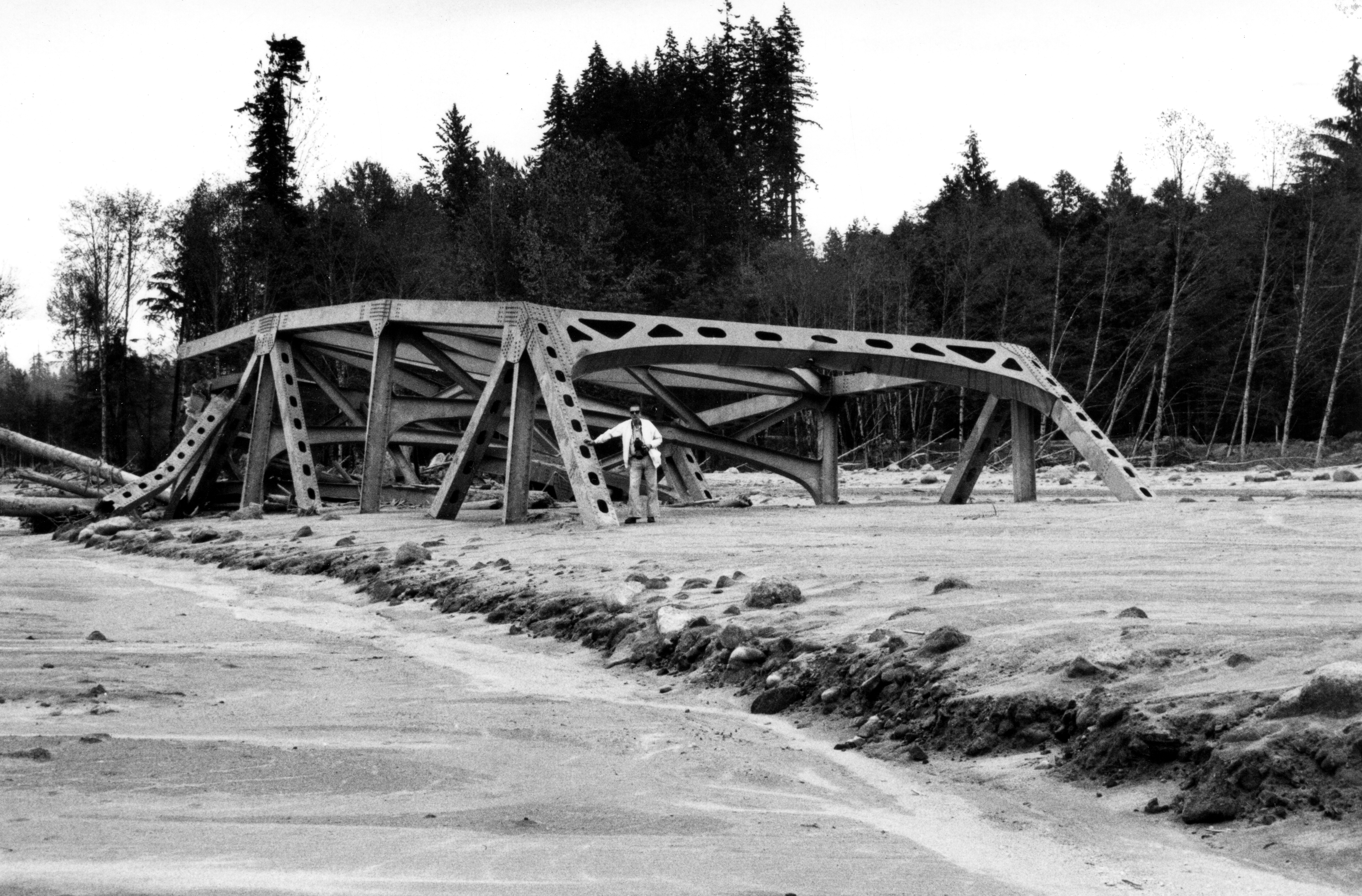
| Description | The 75-m (247-ft) St. Helens bridge on State Highway 504 after May 18 eruption of Mount St. Helens when it was washed out by the mudflow on the North Fork Toutle River. This steel structure was carried about half km (quarter mile) downstream and was partially buried by the mudflow. Man for scale by bridge girder. | |||
| Date | ||||
| Source | Mount St. Helens - PP 1250 136 (original) The St. Helens bridge on Highway 504 was carried over a quarter-mile (alternative) | |||
| Author | R.L. Schuster, United States Geological Survey | |||
| Permission (Reusing this file) |
| |||
| Other versions |  |
File history
Click on a date/time to view the file as it appeared at that time.
| Date/Time | Thumbnail | Dimensions | User | Comment | |
|---|---|---|---|---|---|
| current | 17:18, 24 August 2014 | | 5,643 × 3,714 (9.92 MB) | SounderBruce | {{Information |Description=The 75-m (247-ft) St. Helens bridge on State Highway 504 after May 18 eruption of Mount St. Helens when it was washed out by the mudflow on the [[w:... |
File usage
The following pages on the English Wikipedia use this file (pages on other projects are not listed):
Global file usage
The following other wikis use this file:
- Usage on azb.wikipedia.org
- Usage on cs.wikipedia.org