File:Durham map small.svg
 From Wikipedia the free encyclopedia

Size of this PNG preview of this SVG file: 598 × 600 pixels. Other resolutions: 239 × 240 pixels | 479 × 480 pixels | 766 × 768 pixels | 1,021 × 1,024 pixels | 2,042 × 2,048 pixels | 668 × 670 pixels.
Original file (SVG file, nominally 668 × 670 pixels, file size: 1.97 MB)
| This is a file from the Wikimedia Commons. Information from its description page there is shown below. Commons is a freely licensed media file repository. You can help. |
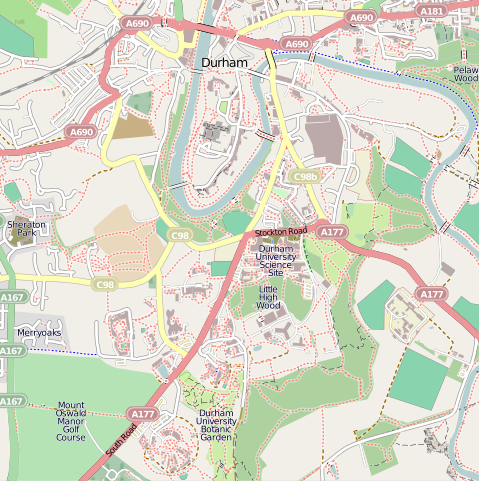
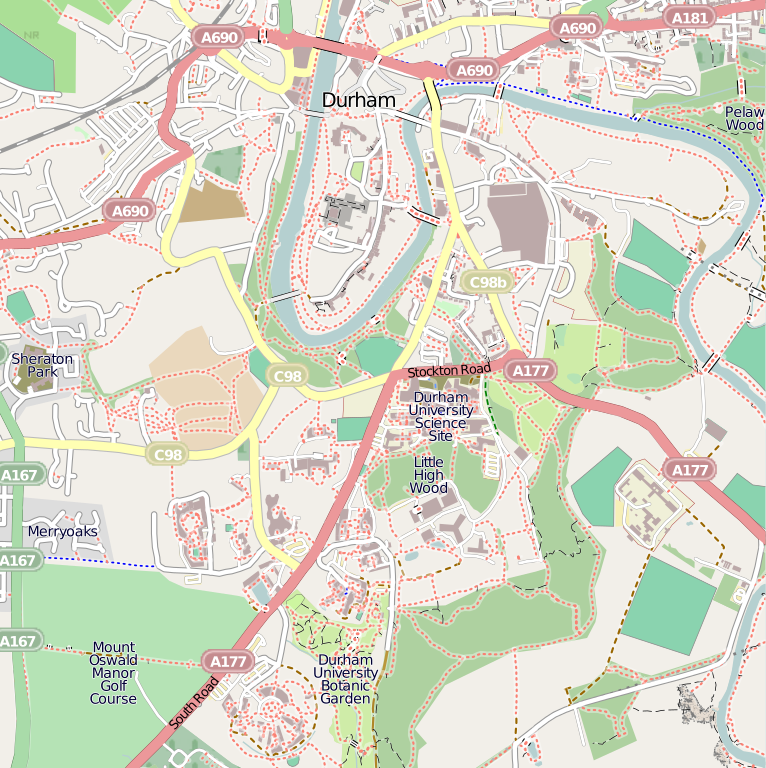
| Description | Map of Durham. Extracted from OpenStreetMap. |
| Source | OpenStreetMap |
| Author | Wereon (talk · contribs) |
| Permission (Reusing this file) | This file is licensed under the Creative Commons Attribution-Share Alike 2.0 Generic license.
|
File history
Click on a date/time to view the file as it appeared at that time.
| Date/Time | Thumbnail | Dimensions | User | Comment | |
|---|---|---|---|---|---|
| current | 23:26, 13 November 2010 | | 668 × 670 (1.97 MB) | Allialliw | Category:Durham Category:Durham Area Transit Authority Category:OpenStreetMap maps of the United Kingdom |
| 18:09, 24 January 2009 |  | 536 × 536 (621 KB) | Wereon | widened river; cleanup | |
| 13:54, 24 January 2009 |  | 536 × 536 (1.09 MB) | Wereon | Map of Durham. Extracted from OpenStreetMap. {{CC-BY-SA 2.0}} Category:Durham Category:Maps of cities in the United Kingdom Category:OpenStreetMap maps <!--{{ImageUpload|basic}}--> |
File usage
The following pages on the English Wikipedia use this file (pages on other projects are not listed):
- Bishop Cosin's Hall
- College of St Hild and St Bede, Durham
- Colleges of Durham University
- Collingwood College, Durham
- Durham Cathedral
- Durham University
- Durham University Library
- Durham University Museum of Archaeology
- Durham University Observatory
- Durham University Oriental Museum
- Grey College, Durham
- Hatfield College, Durham
- Institute of Advanced Study (Durham)
- John Snow College, Durham
- Josephine Butler College, Durham
- Missoula (nightclub)
- Palace Green
- South College, Durham
- St Aidan's College, Durham
- St Chad's College, Durham
- St Cuthbert's Church, Durham
- St Cuthbert's Society, Durham
- St John's College, Durham
- St Margaret's Church, Durham
- St Mary's College, Durham
- St Nicholas Church, Durham
- Stephenson College, Durham
- Trevelyan College, Durham
- University College, Durham
- Ustinov College, Durham
- Van Mildert College, Durham
- User:TSP/sandbox
- Template:Durham University map
- Template:Infobox residential college/testcases
- Module:Location map/data/Durham
- Module:Location map/data/United Kingdom Durham
- Module:Location map/data/United Kingdom Durham/doc
Global file usage
The following other wikis use this file:
- Usage on ar.wikipedia.org
- Usage on ceb.wikipedia.org
- Usage on el.wikipedia.org
- Usage on en.wikivoyage.org
- Usage on es.wikipedia.org
- Usage on fa.wikipedia.org
- Usage on fy.wikipedia.org
- Usage on kn.wikipedia.org
- Usage on no.wikipedia.org
- Usage on ro.wikipedia.org
- Usage on si.wikipedia.org
- Usage on tr.wikipedia.org
- Usage on uk.wikipedia.org
- Usage on uz.wikipedia.org
- Usage on war.wikipedia.org
- Usage on www.wikidata.org