File:Dresdner Schloss DDR-Zustand.jpg
 From Wikipedia the free encyclopedia
Size of this preview: 798 × 600 pixels. Other resolutions: 320 × 240 pixels | 639 × 480 pixels | 1,022 × 768 pixels | 1,280 × 962 pixels | 1,395 × 1,048 pixels.
Original file (1,395 × 1,048 pixels, file size: 752 KB, MIME type: image/jpeg)
| This is a file from the Wikimedia Commons. Information from its description page there is shown below. Commons is a freely licensed media file repository. You can help. |
Summary
| Camera location | | View this and other nearby images on: OpenStreetMap |
|---|
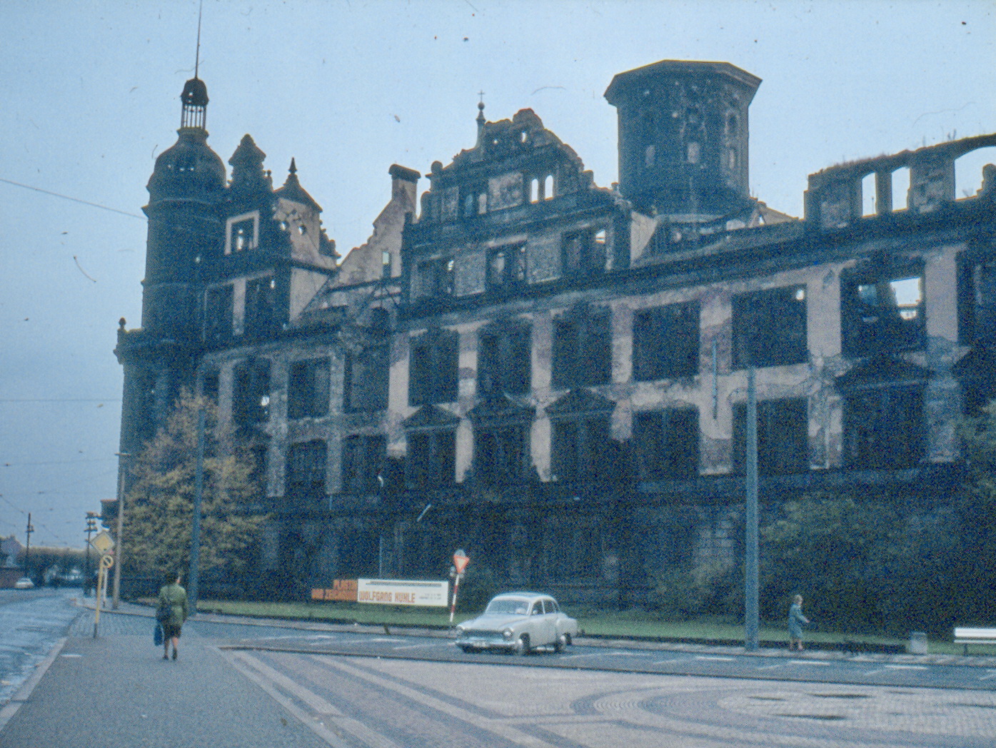
| Description | Deutsch: Dresdner Schloss, zerstört 1945 bis zum (äußerlichem) Wiederaufbau 1985–2000. English: The Castle of Dresden, destroyed after 1945 before restauration in 2000. | ||
| Date | |||
| Source | Own work | ||
| Author | Gabriele Delhey | ||
| Permission (Reusing this file) |
|
| Object location | | View this and other nearby images on: OpenStreetMap |
|---|
Licensing
 | Permission is granted to copy, distribute and/or modify this document under the terms of the GNU Free Documentation License, Version 1.2 or any later version published by the Free Software Foundation; with no Invariant Sections, no Front-Cover Texts, and no Back-Cover Texts. A copy of the license is included in the section entitled GNU Free Documentation License. |
| This file is licensed under the Creative Commons Attribution-Share Alike 3.0 Unported license. | ||
| ||
| This licensing tag was added to this file as part of the GFDL licensing update. |
File history
Click on a date/time to view the file as it appeared at that time.
| Date/Time | Thumbnail | Dimensions | User | Comment | |
|---|---|---|---|---|---|
| current | 12:03, 20 July 2019 | | 1,395 × 1,048 (752 KB) | Ghirlandajo | lighting |
| 17:46, 10 January 2008 |  | 1,395 × 1,048 (776 KB) | 32X | lossless crop | |
| 20:16, 7 March 2006 |  | 1,396 × 1,064 (839 KB) | GDelhey | The Dresden Castle after destruction 1945, before restaurantion in 2000, created by Gabriele Delhey in October 1980 | |
| 20:12, 7 March 2006 |  | 1,396 × 1,064 (839 KB) | GDelhey | The Castle of Dresden, destroyed after 1945 before restauration in 2000, created in October 1980 by Gabriele Delhey |
File usage
The following pages on the English Wikipedia use this file (pages on other projects are not listed):
Global file usage
The following other wikis use this file:
- Usage on az.wikipedia.org
- Usage on ca.wikipedia.org
- Usage on de.wikipedia.org
- Usage on el.wikipedia.org
- Usage on fa.wikipedia.org
- Usage on hy.wikipedia.org
- Usage on it.wikipedia.org
- Usage on ru.wikipedia.org
- Usage on sl.wikipedia.org
- Usage on zh.wikipedia.org