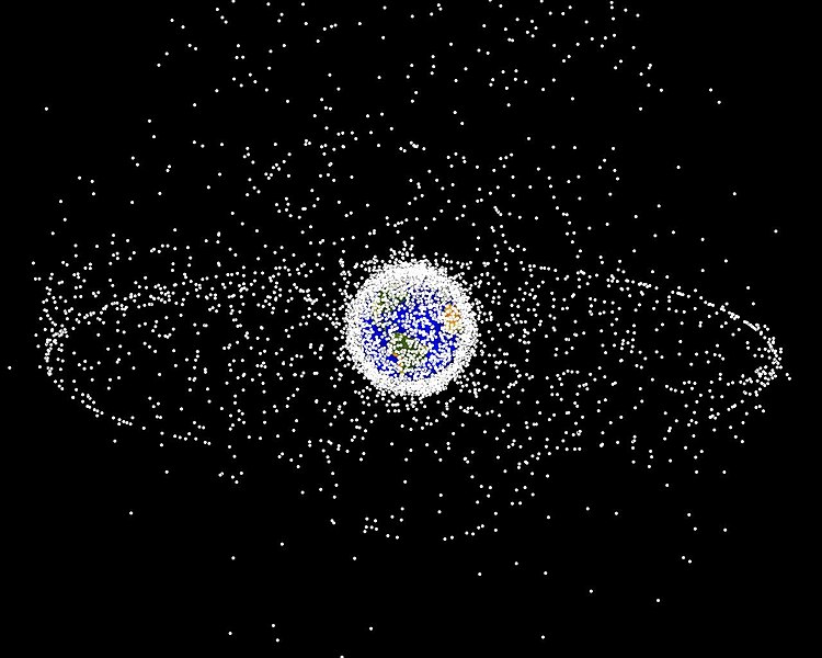
File:Debris-GEO1280.jpg
 From Wikipedia the free encyclopedia

Original file (1,280 × 1,024 pixels, file size: 125 KB, MIME type: image/jpeg)
File history
Click on a date/time to view the file as it appeared at that time.
| Date/Time | Thumbnail | Dimensions | User | Comment | |
|---|---|---|---|---|---|
| current | 16:45, 1 February 2005 |  | 1,280 × 1,024 (125 KB) | Srbauer | debris plot by NASA |
File usage
- Catcher's Mitt
- Earth
- Envisat
- Geostationary orbit
- Geosynchronous orbit
- Human presence in space
- International Space Station
- Kessler syndrome
- Outer space
- Planetes
- Space Surveillance Telescope
- Spacecraft cemetery
- Talk:Geostationary orbit
- User:FreshYoMama/TWA/Earth
- User:FreshYoMama/TWA/Earth/2
- User:Ginnybarnes/Spacecraft cemetery
- User:Mumuhuohuo
- User talk:Penyulap/staticEnglish
- Portal:Outer space
- Portal:World
- Draft:Space Congestion
Global file usage
The following other wikis use this file:
- Usage on af.wikipedia.org
- Usage on an.wikipedia.org
- Usage on ar.wikipedia.org
- Usage on az.wikipedia.org
- Usage on be-tarask.wikipedia.org
- Usage on be.wikipedia.org
- Usage on bn.wikipedia.org
- Usage on ca.wikipedia.org
- Usage on cs.wikipedia.org
- Usage on da.wikipedia.org
- Usage on de.wikipedia.org
- Usage on de.wiktionary.org
- Usage on el.wikipedia.org
- Usage on en.wikinews.org
- Usage on eo.wikipedia.org
- Usage on es.wikipedia.org
- Usage on et.wikipedia.org
- Usage on eu.wikipedia.org
- Usage on fa.wikipedia.org
- Usage on fi.wikipedia.org
- Usage on fr.wikipedia.org
- Ascenseur spatial
- Débris spatial
- Pollution spatiale
- Portail:Astronautique/Maintenance Lumière sur
- Syndrome de Kessler
- Portail:Astronautique/Lumière sur/24
- Wikipédia:Lumière sur/Débris spatial
- Wikipédia:Sélection/Astronautique
- Utilisatrice:Alpha Orionis643/Brouillon
- Projet:Aide et accueil/Twitter/Tweets/archives/avril 2021
- Usage on gl.wikipedia.org
- Usage on he.wikipedia.org
View more global usage of this file.


