European long-distance paths
 From Wikipedia the free encyclopedia
This article has multiple issues. Please help improve it or discuss these issues on the talk page. (Learn how and when to remove these messages)
|
| E-paths | |
|---|---|
 | |
 | |
| System information | |
| Length | 65,000 km (40,000 mi) |
| Formed | 1995 |
| Highway names | |
| E-path | E nn |
| System links | |
The European long-distance paths (E-paths) are a network of long-distance footpaths that traverse Europe. While most long-distance footpaths on the continent are located in just one country or region, each of these numbered long-distance trails passes through many countries.
The first long-distance hiking trail in Europe was the National Blue Trail of Hungary, established in 1938. The formation of the European Union in 1993 made transnational hiking trails possible. Presently, the network consists of 12 paths and covers more than 65,000 kilometres (40,000 mi), crisscrossing the continent. In general, the routes connect and make use of existing national and local trails, such as the GR footpaths.
The trails are officially designated by the European Ramblers' Association.
List
[edit]| # | Map | Route | Length |
|---|---|---|---|
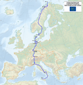
| E1 |  | Norway •Finland • Sweden • Denmark • Germany • Switzerland • Italy | 7,000 kilometres (4,300 mi) |
| E2 |  | Ireland • United Kingdom • Netherlands • Belgium • Luxembourg • France | 4,850 kilometres (3,010 mi) |
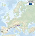
| E3 |  | Portugal • Spain • France • Belgium • Luxembourg • Germany • Czech Republic • Poland • Slovakia • Hungary • Romania • Bulgaria • Turkey | 6,950 kilometres (4,320 mi) |
| E4 |  | Portugal • Spain • France • Switzerland • Germany • Austria • Hungary • Romania • Serbia • Bulgaria • Greece • Cyprus | 10,000 kilometres (6,200 mi) |
| E5 |  | France • Switzerland • Germany • Austria • Italy | 3,200 kilometres (2,000 mi) |
| E6 |  | Finland • Sweden • Denmark • Germany • Austria • Slovenia • Croatia • Greece • Turkey | 6,300 kilometres (3,900 mi)[1] |
| E7 |  | Portugal • Spain • Andorra • France • Italy • Slovenia • Croatia • Hungary • Serbia | 6,000 kilometres (3,700 mi)[2] |
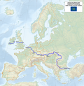
| E8 |  | Ireland • United Kingdom • Netherlands • Germany • Austria • Slovakia • Poland • Ukraine • Romania • Bulgaria • Turkey | 4,700 kilometres (2,900 mi) |
| E9 |  | Portugal • Spain • France • United Kingdom • Belgium • Netherlands • Germany • Poland • Kaliningrad Oblast • Lithuania • Latvia • Estonia | 5,000 kilometres (3,100 mi) |
| E10 |  | Finland • Germany • Czech Republic • Austria • Italy • France • Spain | 2,880 kilometres (1,790 mi)[3] |
| E11 |  | Netherlands • Germany • Poland • Lithuania • Latvia • Estonia | 3,506 kilometres (2,179 mi) |
| E12 |  | Spain • France • Italy • Slovenia • Croatia | 1,800 kilometres (1,100 mi) |
See also
[edit]- Transcaucasian Trail
- Geography of Europe
- EuroVelo, European cycle route network
- Long-distance trails in the United States
References
[edit]- ^ https://www.era-ewv-ferp.org/e-paths/e6/ European Ramblers Association
- ^ https://www.era-ewv-ferp.org/e-paths/e7/ European Ramblers Association
- ^ https://www.era-ewv-ferp.org/e-paths/e10/ European Ramblers Association
External links
[edit]- Overview of the paths (European Ramblers' Association)
- All hiking trails (Waymarkedtrails.org)
- OpenStreetMap project on E-paths (Openstreetmap.org)