ملف:Poland & The New Baltic States.jpg

حجم هذه المعاينة: 462 × 599 بكسل. الأبعاد الأخرى: 185 × 240 بكسل | 370 × 480 بكسل | 592 × 768 بكسل | 790 × 1٬024 بكسل | 1٬376 × 1٬784 بكسل.
الملف الأصلي (1٬376 × 1٬784 بكسل حجم الملف: 1٫22 ميجابايت، نوع MIME: image/jpeg)
| هذا ملف من ويكيميديا كومنز. معلومات من صفحة وصفه مبينة في الأسفل. كومنز مستودع ملفات ميديا ذو رخصة حرة. |
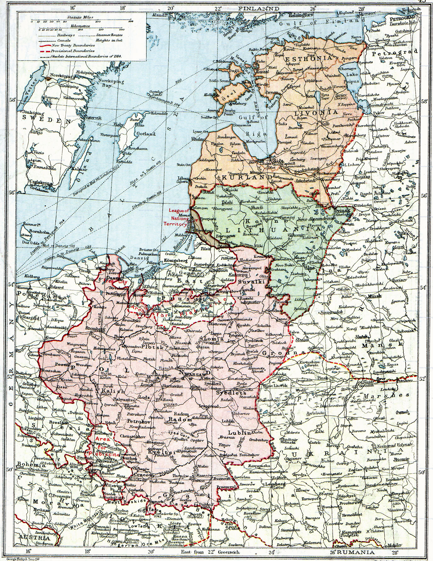
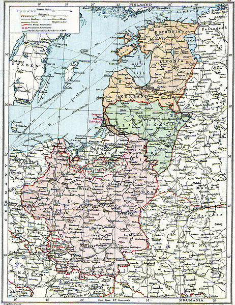
| الوصف | English: Map of Poland, en:Lithuania, en:Courland, en:Livonia and en:Esthonia published in the 1920 edition of The Peoples Atlas by London Geographical Institute. The map shows the situation after the treaties of Versailles and Brest-Litovsk and before the en:Peace of Riga and the organization and recognition of the nation-states of en:Estonia and en:Latvia. Note that most names featured on this map are pre-1914 Russian names put in English transcription, rather than local or English names as such. |
| التاريخ | |
| المصدر | This uploaded map is a photoshopped version of the original image located at Image:London-geographical-institute the-peoples-atlas 1920 poland-and-the-new-baltic-states.jpg or [1]. Originally uploaded to EN Wikipedia as en:Image:Poland & The New Baltic States.jpg by en:User:MaGioZal 26 December 2007 |
| المؤلف | London Geographical Institute |
| الترخيص (إعادة استخدام هذا الملف) | According to the site, there are no copyrights to this map. |
| إصدارات أخرى | Image:London-geographical-institute the-peoples-atlas 1920 poland-and-the-new-baltic-states.jpg |
يقع ملفُ الوسائط هذا في النِّطاق العامّ داخل الولايات المُتحدة الأمريكيَّة. وهذا ينطبق على الأعمال أمريكيَّة الأصل التي نفدت مدة حقوق تأليفها ونشرها، وهذا في الغالب الأعم عائدٌ إلى نشرها للمرة الأولى مرة قبل 1 يناير، ١٩٢٩. راجع هذه الصفحة للمزيد من التوضيح. |  | |
 | قد لا تكون هذه الصورة في النِّطاق العامّ من خارج الولايات المُتحدة، وهذا ينطبق بشكلٍ خاصٍّ في البلدان والمناطق التي لا يكون حكم الفترة الأقصر فيها نافذاً على الأعمال الأمريكية، مثل كندا وجمهورية الصين (ما خلا هونغ كونغ وماكاو) وألمانيا والمكسيك وسويسرا. إنَّ اسم المُؤَلِّف وسنة النشر هما من المعلومات الأساسيَّة، ولا بدَ من ذكرهما. انظر ويكيبيديا:الملكية العامة وويكيبيديا:حقوق التأليف والنشر للمزيد من التفاصيل. |
تاريخ الملف
اضغط على زمن/تاريخ لرؤية الملف كما بدا في هذا الزمن.
| زمن/تاريخ | صورة مصغرة | الأبعاد | مستخدم | تعليق | |
|---|---|---|---|---|---|
| حالي | 14:06، 26 يونيو 2010 | | 1٬376 × 1٬784 (1٫22 ميجابايت) | Ras67 | losslessly cropped with Jpegcrop |
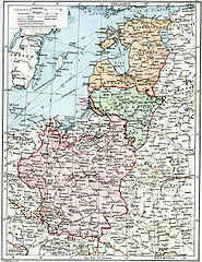
| 07:47، 3 أغسطس 2008 |  | 1٬506 × 1٬996 (1٫28 ميجابايت) | Rcbutcher | {{Information |Description=Map of Poland, Lithuania, Courland, Livonia and Esthonia published in the 1920 edition of ''The Peoples Atlas'' by London Geographical Institute. The map shows the situation after the treaties of [[Treaty of |
استخدام الملف
ال5 صفحات التالية تستخدم هذا الملف:
الاستخدام العالمي للملف
الويكيات الأخرى التالية تستخدم هذا الملف:
- الاستخدام في bat-smg.wikipedia.org
- الاستخدام في ba.wikipedia.org
- الاستخدام في ca.wikipedia.org
- الاستخدام في da.wikipedia.org
- الاستخدام في de.wikipedia.org
- الاستخدام في en.wikipedia.org
- الاستخدام في et.wikipedia.org
- الاستخدام في fi.wikipedia.org
- الاستخدام في fr.wikipedia.org
- الاستخدام في gl.wikipedia.org
- الاستخدام في it.wikipedia.org
- الاستخدام في ja.wikipedia.org
- الاستخدام في lt.wikipedia.org
- الاستخدام في lt.wikibooks.org
- الاستخدام في lv.wikipedia.org
- الاستخدام في no.wikipedia.org
- الاستخدام في ro.wikipedia.org
- الاستخدام في ru.wikipedia.org
- الاستخدام في sl.wikipedia.org
- الاستخدام في sr.wikipedia.org
- الاستخدام في sv.wikipedia.org
- الاستخدام في tr.wikipedia.org
- الاستخدام في uk.wikipedia.org
- الاستخدام في uz.wikipedia.org
اعرض المزيد من الاستخدام العام لهذا الملف.