ملف:Northern England-Historic counties.svg


حجم معاينة PNG لذلك الملف ذي الامتداد SVG: 473 × 599 بكسل. الأبعاد الأخرى: 189 × 240 بكسل | 379 × 480 بكسل | 606 × 768 بكسل | 808 × 1٬024 بكسل | 1٬616 × 2٬048 بكسل | 809 × 1٬025 بكسل.
الملف الأصلي (ملف SVG، أبعاده 809 × 1٬025 بكسل، حجم الملف: 933 كيلوبايت)
| هذا ملف من ويكيميديا كومنز. معلومات من صفحة وصفه مبينة في الأسفل. كومنز مستودع ملفات ميديا ذو رخصة حرة. |
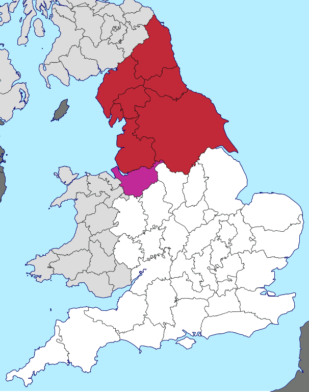
| الوصف | English: Northern England, as defined along historic county boundaries |
| التاريخ | |
| المصدر | British Isles in counties.svg |
| المؤلف | User:Visitor from Wikishire. This particular view by User:Inops |
| الترخيص (إعادة استخدام هذا الملف) | هذا الملفُّ مُرخَّصٌ برخصة المشاع الإبداعي الدَّوليَّة المُلزِمة بنسب العمل إلى مُؤَلِّفه وبترخيص المُشتقَّات بالمثل 4.0. نسب العمل لمُؤَلِّفه: Wikishire
|
تاريخ الملف
اضغط على زمن/تاريخ لرؤية الملف كما بدا في هذا الزمن.
| زمن/تاريخ | صورة مصغرة | الأبعاد | مستخدم | تعليق | |
|---|---|---|---|---|---|
| حالي | 20:25، 29 أبريل 2018 | | 809 × 1٬025 (933 كيلوبايت) | Inops | make France the right colour |
| 13:29، 27 يونيو 2017 |  | 809 × 1٬025 (933 كيلوبايت) | Inops | change to darker shade of red, and change colour of Cheshire to indicate its sometime exclusion | |
| 16:47، 26 يونيو 2017 |  | 809 × 1٬025 (933 كيلوبايت) | Inops | {{Information |Description=Northern England, as defined on historic county boundaries |Source=British Isles in counties.svg |Date=2017-06-26 |Author=User:Visitor from Wikishire. This particular view by [[User... |
استخدام الملف
الصفحة التالية تستخدم هذا الملف:
الاستخدام العالمي للملف
الويكيات الأخرى التالية تستخدم هذا الملف:
- الاستخدام في bn.wikipedia.org
- الاستخدام في en.wikipedia.org
- الاستخدام في vi.wikipedia.org
- الاستخدام في zh.wikipedia.org