ملف:Egypt map arabic.jpg


حجم هذه المعاينة: 545 × 600 بكسل. الأبعاد الأخرى: 218 × 240 بكسل | 436 × 480 بكسل | 727 × 800 بكسل.
الملف الأصلي (727 × 800 بكسل حجم الملف: 58 كيلوبايت، نوع MIME: image/jpeg)
| هذا ملف من ويكيميديا كومنز. معلومات من صفحة وصفه مبينة في الأسفل. كومنز مستودع ملفات ميديا ذو رخصة حرة. |
ملخص
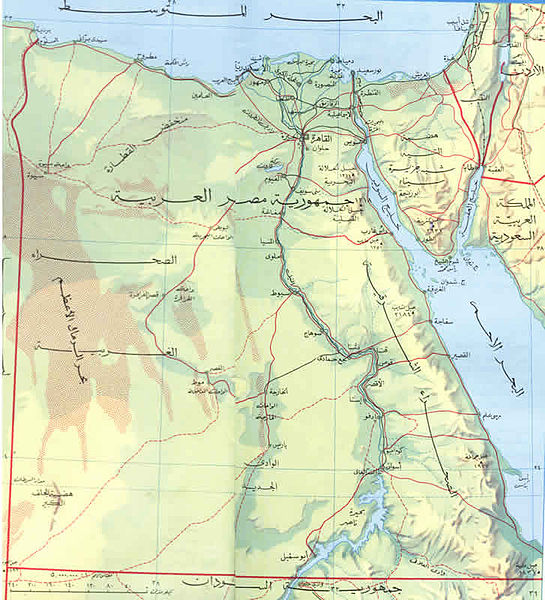
| الوصف | العربية: خريطة توضح حدود مصر الجغرافية والمدن الر ئيسية بها |
| التاريخ | |
| المصدر | كتاب اطلس المدارس |
| المؤلف | وزارة التعليم |
ترخيص
 | The author of this work is anonymous and this work was made available to the public more than 50 years ago. According to the Berne convention Art. 7, and the laws of many countries, this work is in the public domain. Note: This template does not apply to works from countries that extended the Berne Convention or that did not sign it. In particular, this includes the European Union, the United States, India, and Russia. Please use {{PD-anon-70-EU}}, {{PD-US}}, {{PD-India}}, {{PD-Russia-1996}}, etc. in such cases and check Commons:Anonymous works every time, carefully! |
تاريخ الملف
اضغط على زمن/تاريخ لرؤية الملف كما بدا في هذا الزمن.
| زمن/تاريخ | صورة مصغرة | الأبعاد | مستخدم | تعليق | |
|---|---|---|---|---|---|
| حالي | 21:33، 6 فبراير 2013 | | 727 × 800 (58 كيلوبايت) | Omda4wady | User created page with UploadWizard |
استخدام الملف
ال7 صفحات التالية تستخدم هذا الملف:
الاستخدام العالمي للملف
الويكيات الأخرى التالية تستخدم هذا الملف: