ملف:Archipiélago de Chiloé-blank.PNG


حجم هذه المعاينة: 456 × 599 بكسل. الأبعاد الأخرى: 182 × 240 بكسل | 365 × 480 بكسل | 584 × 768 بكسل | 1٬100 × 1٬446 بكسل.
الملف الأصلي (1٬100 × 1٬446 بكسل حجم الملف: 1٬017 كيلوبايت، نوع MIME: image/png)
| هذا ملف من ويكيميديا كومنز. معلومات من صفحة وصفه مبينة في الأسفل. كومنز مستودع ملفات ميديا ذو رخصة حرة. |
| الوصف | |||||
| التاريخ | |||||
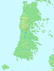
| المصدر | Español: Mapa en el dominio público English: PD map | ||||
| المؤلف | Lin linao | ||||
| الترخيص (إعادة استخدام هذا الملف) |
|
تاريخ الملف
اضغط على زمن/تاريخ لرؤية الملف كما بدا في هذا الزمن.
| زمن/تاريخ | صورة مصغرة | الأبعاد | مستخدم | تعليق | |
|---|---|---|---|---|---|
| حالي | 19:15، 1 ديسمبر 2011 | | 1٬100 × 1٬446 (1٬017 كيلوبايت) | Lin linao | Mejora de resolución y corrección de las bahías y fiordos que estaban marcados como cuerpos de agua interior. |
| 16:29، 5 سبتمبر 2007 |  | 280 × 369 (21 كيلوبايت) | Lin linao | {{Information |Description={{es|Mapa del Archipiélago de Chiloé (Chile)}} |Source= {{es|Mapa en el dominio público}}{{en|PD map}} |Date=5 de septiembre, 2007 |Author= Lin linao |Permission={{Demis |
استخدام الملف
ال18 صفحة التالية تستخدم هذا الملف:
- أرخبيل تشيلوي
- كنائس تشيلوي
- كنيسة آلداتشيلدو
- كنيسة إتشواك
- كنيسة بيلوبويي
- كنيسة تشونتشي
- كنيسة تشيلين
- كنيسة ديتيف
- كنيسة سان خوان باوتيستا (دالكاوي)
- كنيسة سان فرانثيسكو (كاسترو)
- كنيسة سانتا ماريا دي ريلان
- كنيسة سانتا ماريا دي لوريتو (آتشاو)
- كنيسة سيدة الأحزان (دالكاوي)
- كنيسة سيدة جراثيا دي نيركون
- كنيسة كاجواتش
- كنيسة كولو
- كنيسة كينتشاو
- قالب:Location map Chiloé
الاستخدام العالمي للملف
الويكيات الأخرى التالية تستخدم هذا الملف:
- الاستخدام في bg.wikipedia.org
- الاستخدام في br.wikipedia.org
- الاستخدام في ca.wikipedia.org
- الاستخدام في ceb.wikipedia.org
- الاستخدام في cs.wikipedia.org
- الاستخدام في da.wikipedia.org
- الاستخدام في de.wikipedia.org
- الاستخدام في en.wikipedia.org
- Churches of Chiloé
- Chiloé Island
- Ancud
- Trauco
- Chacao Channel
- Curanto
- Gulf of Corcovado
- Gulf of Ancud
- Guafo Island
- Chilote mythology
- Chilotan architecture
- Chiloé Archipelago
- Quinchao Island
- Lemuy Island
- Quemchi
- Licor de oro
- Sirena chilota
- Dalcahue Channel
- Roca Remolinos
- Estero de Castro
- Template:Chiloe Archipelago
- Caulín Bay
- Sea of Chiloé
- Tranqui Island
- Cuisine of Chiloé
- Desertores Islands
- Chilote cap
- Quinchao
- Chapalele
- Chilote poncho
- Potatoes of Chiloé
- Module:Location map/data/Chile Chiloé/doc
- Cucao and Huillinco
- Church of Santa María de Loreto, Achao
- Church of San Juan Bautista, Dalcahue
- User:Jmvgpartner/Test
- Huilliche uprising of 1712
- Chilote School of Religious Imagery
- Church of San Francisco, Castro
- Church of Our Lady of Sorrows, Dalcahue
- Church of Caguach
اعرض المزيد من الاستخدام العام لهذا الملف.