قائمة مدن الفلبين

هذه قائمة بالمدن الرسمية في دولة الفلبين. تصنف المدن الفلبينية إلى ثلاث مجموعات: مدن عالية التحضر (HUC)، مدن مستقلة التكوين ( ICC) ، مدن محافظاتية، أي تتبع سياسيا لمحافظة معينة (CC).
تصنيفات[عدل]
المدن عالية التحضر هي وحدات حكومية محلية مستقلة عن المحافظات التي يقل عدد سكانها عن 200,000 ودخلها السنوي لا يقل عن 50 مليون دولار (في عام 1991 بالأسعار الثابتة). بينما تصنف المدن مستقلة التكوين كمدن خارج اختصاص المحافظات (على الرغم من أن بعضها يسمح لها بالمشاركة في انتخابات مسؤولين المحافظة) التي لم تنل بعد درجة المدن عالية التحضر، في حين تصنف المدن المحافظاتية كمدن ضمن إطار محافظة الاختصاص. بالإضافة إلى ذلك، يتم تصنيف كل مدينة إلى ست شرائح وفقًا للدخل في فترة أربع سنوات. على سبيل المثال، في الدرجة الأولى تأتي المدن التي لديها دخل من 400 مليون دولار أو أكثر، في حين تأتي في الدرجة السادسة المدن التي تكسب أقل من 80 مليون دولار في فترة أربع سنوات.
-
 مدينة كيزون، أكبر منطقة مأهولة بالسكان
 -
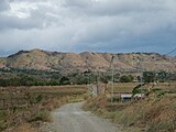 بالايان، أقل المناطق المأهولة بالسكان
 -
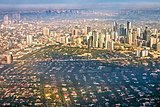 مانيلا، العاصمة وأكبر المدن من حيث الكثافة السكانية
 -
 بويرتو برينسا، الأصغر من حيث الكثافة السكانية


قائمة[عدل]
تم تصنيف 145 مدينة فلبينية اعتبارًا من 30 سبتمبر 2016. تصنف ثلاثة وثلاثين من هذه المدن كمدن عالية التحضر (HUC) و يصنف خمس منها كمدن مستقلة التكوين (ICC) ، بينما يصنف الباقي كمدن مدمجة التكوين (CC) تبعًا للمحافظات المختصة.يمكن الوصول إلى ميثاق المدينة إذا كانت متاحة عن طريق النقر على الروايط الخارجية (يشير CA إلى قانون الكومنولث, بينما يشير RA إلى قانون الجمهورية).
هذه قائمة بالمدن الرسمية في دولة الفلبين. تصنف المدن الفلبينية إلى ثلاث مجموعات: مدن عالية التحضر (HUC) ، مدن مستقلة التكوين ( ICC) ، مدن مكونة أو محافظاتية ( CC).
المدن[عدل]
| المدينة | تعداد السكان (2015 | المساحة | الكثافة السكانية (2015) | المقاطعة | المنطقة | التصنيف القانوني [2] | الميثاق | تاريخ | ||
|---|---|---|---|---|---|---|---|---|---|---|
| القبول | التصديق | |||||||||
| 16°09′23″N 119°58′49″E / 16.1565°N 119.9804°E | ألامينوس | 89,708 | 164.26 كـم2 (63.42 ميل2) | 550/كم2 (1,400/ميل2) | بانغاسينان | I | CC | RA 09025 [3] | 2001 مارس5 [3] | 2001 مارس 28 [4] |
| 15°08′24″N 120°35′16″E / 15.1399°N 120.5879°E | أنغيليس | 411,634 | 60.27 كـم2 (23.27 ميل2) | [convert: invalid number] | بامبانغا | III | HUC | RA 03700 [5] | 22 يونيو 1963 [5] | 1964 يناير 1 |
| 14°35′13″N 121°10′33″E / 14.5870°N 121.1758°E | أنتيبولو | 776,386 | 306.10 كـم2 (118.19 ميل2) | [convert: invalid number] | ريزال | IV-A | CC | RA 08508 [6] | 1998 فبراير 13 [6] | 4 أبريل 1998 |
| 10°40′34″N 122°57′05″E / 10.6762°N 122.9513°E | باكولود | 561,875 | 162.67 كـم2 (62.81 ميل2) | [convert: invalid number] | نيغروس الغربية | NIR | HUC | CA 326 [7] | 1938 يونيو 18[8] | 14 أكتوبر 1938 [9] |
| 14°27′34″N 120°56′24″E / 14.4594°N 120.9401°E | باكور | 600,609 | 46.17 كـم2 (17.83 ميل2) | [convert: invalid number] | كاويته | IV-A | CC | RA 10160 [10] | 10 أبريل 2012 [10] | 23 يونيو 2012 [11] |
| 10°32′24″N 122°50′09″E / 10.5401°N 122.8357°E | باجو | 170,981 | 401.20 كـم2 (154.90 ميل2) | 430/كم2 (1,100/ميل2) | نيغروس الغربية | NIR | CC | RA 04382 [12] | 1965 يونيو 19 [12] | 1966 فبراير 19 [13] |
| 16°24′43″N 120°35′36″E / 16.4120°N 120.5933°E | باجيو | 345,366 | 57.51 كـم2 (22.20 ميل2) | [convert: invalid number] | بينجويت | CAR | HUC | Act 1963 | 1 سبتمبر 1909 | 1 سبتمبر 1909 |
| 9°35′29″N 123°07′17″E / 9.5914°N 123.1213°E | بيز | 76,291 | 319.64 كـم2 (123.41 ميل2) | 240/كم2 (620/ميل2) | نيغروس الشرقية | NIR | CC | RA 05444 [14] | 9 سبتمبر 1968 [14] | 9 سبتمبر 1968 |
| 14°40′46″N 120°32′27″E / 14.6795°N 120.5409°E | بالانجا | 96,061 | 111.63 كـم2 (43.10 ميل2) | 860/كم2 (2,200/ميل2) | باتان | III | CC | RA 08984 [15] | 5 ديسمبر 2000 [15] | 30 ديسمبر 2000 |
| 18°03′24″N 120°33′50″E / 18.0566°N 120.5639°E | باتاك | 55,201 | 161.06 كـم2 (62.19 ميل2) | 340/كم2 (880/ميل2) | ايلوكوس نورتي | I | CC | RA 09407 [16] | 2007 مارس24 [16] | 23 يونيو 2007 [17] |
| 13°45′22″N 121°03′28″E / 13.7561°N 121.0577°E | باتانغاس | 329,874 | 282.96 كـم2 (109.25 ميل2) | [convert: invalid number] | باتانغاس | IV-A | CC | RA 05495 [18] | 21 يونيو 1969 [18] | 21 يونيو 1969 |
| 9°22′00″N 122°48′20″E / 9.3668°N 122.8055°E | باياوان | 117,900 | 699.08 كـم2 (269.92 ميل2) | 170/كم2 (440/ميل2) | نيغروس الغربية | NIR | CC | RA 08983 [19] | 5 ديسمبر 2000 [19] | 23 ديسمبر 2000 |
| 10°40′38″N 124°47′49″E / 10.6771°N 124.7970°E | بايباي | 109,432 | 459.30 كـم2 (177.34 ميل2) | 240/كم2 (620/ميل2) | مقاطعة ليتة | VIII | CC | RA 09389 [20] | 15 ديسمبر 2007 [20] | 2007 [21] |
| 8°42′51″N 125°44′53″E / 8.7143°N 125.7481°E | بايوجان | 103,202 | 688.77 كـم2 (265.94 ميل2) | 150/كم2 (390/ميل2) | اجوسان ديل سور | XIII | CC | RA 09405 [22] | 2007 مارس23 [22] | 2007 يونيو 20 [21] |
| 14°20′19″N 121°05′01″E / 14.3385°N 121.0835°E | بينان | 333,028 | 43.50 كـم2 (16.80 ميل2) | [convert: invalid number] | لاغونا | IV-A | CC | RA 09740 [23] | 2009 أكتوبر 30 [23] | 2010 فبراير 2 [24] |
| 8°12′42″N 126°19′00″E / 8.2116°N 126.3166°E | بيسليغ | 94,535 | 331.80 كـم2 (128.11 ميل2) | 280/كم2 (730/ميل2) | سوريجاو ديل سور | XIII | CC | RA 08804 [25] | 2000 أغسطس 16 [25] | 2000 سبتمبر 18 |
| 11°03′11″N 124°00′40″E / 11.0530°N 124.0110°E | بوغو | 78,120 | 103.52 كـم2 (39.97 ميل2) | 750/كم2 (1,900/ميل2) | سيبو | بيسايا الوسطى | CC | RA 09390 [26] | 2007 مارس15 [26] | 2007 يونيو 16 [21] |
| 11°36′31″N 125°26′07″E / 11.6085°N 125.4353°E | بورونجان | 69,297 | 475.00 كـم2 (183.40 ميل2) | 150/كم2 (390/ميل2) | سامار الشرقية | VIII | CC | RA 09394 [27] | 2007 مارس 16 [27] | 2007 يونيو 20 [21] |
| 8°57′12″N 125°31′44″E / 8.9534°N 125.5288°E | بوتوان | 337,063 | 816.62 كـم2 (315.30 ميل2) | 410/كم2 (1,100/ميل2) | اجوسان ديل نورتي | XIII | HUC | RA 00523 [28] | 1950 يونيو 15 [28] | 1950 أغسطس 2[29] |
| 9°07′17″N 125°31′59″E / 9.1214°N 125.5330°E | كابابدران | 73,639 | 214.44 كـم2 (82.80 ميل2) | 340/كم2 (880/ميل2) | اجوسان ديل نورتي | XIII | CC | RA 09434 [30] | 2007 أبريل 12 [30] | 2007 يوليو 28 [31] |
| 15°29′21″N 120°58′09″E / 15.4891°N 120.9693°E | تشابانتوان | 302,231 | 192.29 كـم2 (74.24 ميل2) | [convert: invalid number] | نويفا ايسيجا | III | CC | RA 00526 [32] | 1950 يونيو 16 [32] | 1950 يوليو 24[33] |
| 14°16′46″N 121°07′25″E / 14.2795°N 121.1235°E | كابوياو | 308,745 | 43.40 كـم2 (16.76 ميل2) | [convert: invalid number] | لاغونا | IV-A | CC | RA 10163 [34] | 2012 مايو 16 [34] | 2012 أغسطس 4 [35] |
| 10°56′46″N 123°17′49″E / 10.9462°N 123.2970°E | قادس | 154,723 | 524.57 كـم2 (202.54 ميل2) | 290/كم2 (750/ميل2) | نيغروس الغربية | NIR | CC | RA 04894 [36] | 1967 يونيو 17 [36] | 1967 يوليو 4[37] |
| 8°28′35″N 124°38′29″E / 8.4763°N 124.6415°E | كاغايان دي أورور | 675,950 | 412.80 كـم2 (159.38 ميل2) | [convert: invalid number] | ميساميس الغربية | مينداناو الشمالية | HUC | RA 00521 [38] | 1950 يونيو 15 [38] | 1950 يونيو 15[39] |
| 14°12′11″N 121°09′44″E / 14.2031°N 121.1623°E | كالامبا | 454,486 | 149.50 كـم2 (57.72 ميل2) | [convert: invalid number] | لاغونا | IV-A | CC | RA 09024 [40] | 2001 مارس 5 [40] | 2001 أبريل 21 |
| 13°24′25″N 121°10′40″E / 13.4070°N 121.1778°E | كالابان | 133,893 | 250.06 كـم2 (96.55 ميل2) | 540/كم2 (1,400/ميل2) | ميندورو الشرقية | IVB | CC | RA 08475 [41] | 1998 فبراير 2 [41] | 1998 مارس 21 |
| 12°04′01″N 124°35′41″E / 12.0669°N 124.5946°E | كالبايوج | 183,851 | 880.74 كـم2 (340.06 ميل2) | 210/كم2 (540/ميل2) | VIII | CC | RA 00328 [42] | 1948 يونيو 15 [42] | 1948 أكتوبر 16[43] | |
| 14°39′26″N 120°59′03″E / 14.6571°N 120.9841°E | كالوكان | 1,583,978 | 55.80 كـم2 (21.54 ميل2) | [convert: invalid number] | NCR | HUC | RA 03278 [44] | 1961 يونيو 17 [44] | 1962 فبراير 16 | |
| 17°11′29″N 120°26′52″E / 17.1914°N 120.4477°E | كاندون | 60,623 | 103.28 كـم2 (39.88 ميل2) | 590/كم2 (1,500/ميل2) | ايلوكوس سور | I | CC | RA 09018 [45] | 2001 مارس 5 [45] | 2001 مارس 28 |
| 10°23′11″N 123°13′28″E / 10.3865°N 123.2245°E | كانلاون | 54,509 | 170.93 كـم2 (66.00 ميل2) | 320/كم2 (830/ميل2) | نيغروس الشرقية | NIR | CC | RA 03445 [46] | 1961 يونيو 18 [46] | 1961 يونيو 18 |
| 10°06′16″N 123°38′51″E / 10.1044°N 123.6474°E | كاركار | 119,664 | 116.78 كـم2 (45.09 ميل2) | [convert: invalid number] | سيبو | بيسايا الوسطى | CC | RA 09436 [47] | 17 أبريل 2007 [47] | 2007 يوليو 1 [31] |
| 11°46′31″N 124°52′58″E / 11.7753°N 124.8829°E | كاتبالوجان | 103,879 | 274.22 كـم2 (105.88 ميل2) | 380/كم2 (980/ميل2) | سامار الغربية | VIII | CC | RA 09391 [48] | 2007 مارس 15 [48] | 2007 يونيو 16 [21] |
| 16°56′03″N 121°46′00″E / 16.9343°N 121.7666°E | كاوايان | 129,523 | 336.40 كـم2 (129.88 ميل2) | 390/كم2 (1,000/ميل2) | ايزابلا | وادي كاغيان | CC | RA 09017 [49] | 2001 فبراير 28 [49] | 2001 مارس 28 |
| 14°28′55″N 120°54′32″E / 14.4820°N 120.9089°E | مدينة كاويتة | 102,806 | 10.89 كـم2 (4.20 ميل2) | [convert: invalid number] | كاويته | IV-A | CC | CA 547 [50] | 1940 مايو 26[33] | 1940 مايو 26[33] |
| 10°18′32″N 123°53′35″E / 10.3090°N 123.8930°E | مدينة سيبو | 922,611 | 315.00 كـم2 (121.62 ميل2) | [convert: invalid number] | سيبو | بيسايا الوسطى | HUC | CA 058 [51] | 1936 أكتوبر 20 | 1937 فبراير 4[52] |
| 7°11′49″N 124°14′06″E / 7.1970°N 124.2351°E | مدينة كوتاباتو | 299,438 | 176.00 كـم2 (67.95 ميل2) | [convert: invalid number] | ماجوينداناو | XII | ICC | RA 02364 [53] | 20 يونيو 1959 [53] | 20 يونيو 1959 |
| 16°02′33″N 120°20′15″E / 16.0424°N 120.3375°E | داغوبان | 171,271 | 37.23 كـم2 (14.37 ميل2) | [convert: invalid number] | بانغاسينان | I | ICC | RA 00170 [54] | 20 يونيو1947 [54] | 1947 يونيو 20[55] |
| 10°31′14″N 124°01′37″E / 10.5205°N 124.0269°E | داناو | 136,471 | 107.30 كـم2 (41.43 ميل2) | [convert: invalid number] | سيبو | بيسايا الوسطى | CC | RA 03028 [56] | 1961 يونيو 7 [56] | 7 يونيو 1961 |
| 8°39′22″N 123°25′39″E / 8.6562°N 123.4274°E | دابيتان | 82,418 | 390.53 كـم2 (150.78 ميل2) | 210/كم2 (540/ميل2) | زامبوانجا | IX | CC | RA 03811 [57] | 1963 يونيو 22 [57] | 1963 يونيو 22 |
| 14°19′37″N 120°56′13″E / 14.3270°N 120.9370°E | داسماريناس | 659,019 | 90.13 كـم2 (34.80 ميل2) | [convert: invalid number] | كاويته | IV-A | CC | RA 09723 [58] | 2009 أكتوبر 15 [58] | 2009 نوفمبر 25 [59] |
| 7°03′50″N 125°36′30″E / 7.0639°N 125.6083°E | دافاو سيتس | 1,632,991 | 2,443.61 كـم2 (943.48 ميل2) | 670/كم2 (1,700/ميل2) | دافاو ديل سور | XI | HUC | CA 051 [60] | 1936 أكتوبر 16[61] | 1 مارس 1937 [61] |
| 6°44′39″N 125°21′23″E / 6.7443°N 125.3565°E | ديغوس | 169,393 | 287.10 كـم2 (110.85 ميل2) | 590/كم2 (1,500/ميل2) | دافاو ديل سور | XI | CC | RA 08798 [62] | 2000 يونيو 15 [62] | 2000 سبتبر 8 |
| 8°34′58″N 123°20′25″E / 8.5827°N 123.3402°E | ديبولوج | 130,759 | 241.13 كـم2 (93.10 ميل2) | 540/كم2 (1,400/ميل2) | زامبوانجا | IX | CC | RA 05520 [63] | 1969 يونيو 21 [63] | 1970 يناير 1 |
| 9°18′19″N 123°18′29″E / 9.3054°N 123.3080°E | دوماغويت | 131,377 | 33.62 كـم2 (12.98 ميل2) | [convert: invalid number] | نيغروس الشرقية | NIR | CC | RA 00327 [64] | 1948 يوليو 15 [64] | 1948 نوفمبر 24[65] |
| 8°31′58″N 124°34′11″E / 8.5328°N 124.5698°E | سالفادور | 50,204 | 106.15 كـم2 (40.98 ميل2) | 470/كم2 (1,200/ميل2) | ميساميس الغربية | مينداناو الشمالية | CC | RA 09435 [66] | 2007 أبريل 12 [66] | 2007 يونيو 27 [21] |
| 10°50′28″N 123°29′57″E / 10.8412°N 123.4992°E | إسكالانتي | 94,070 | 192.76 كـم2 (74.43 ميل2) | 490/كم2 (1,300/ميل2) | نيغروس الغربية | NIR | CC | RA 09014 [67] | 2001 فبراير 28 [67] | 2001 مارس 31 |
| 15°17′52″N 120°57′24″E / 15.2977°N 120.9566°E | غابان | 110,303 | 164.44 كـم2 (63.49 ميل2) | 670/كم2 (1,700/ميل2) | نويفا ايسيجا | III | CC | RA 09022 [68] | 2001 مارس5 [68] | 2001 أغسطس 25 |
| 6°06′50″N 125°10′18″E / 6.1139°N 125.1717°E | جينيرال سانتوس | 594,446 | 492.86 كـم2 (190.29 ميل2) | [convert: invalid number] | كوتاباتو الجنوبية | XII | HUC | RA 05412 [69] | 1968 يونيو 15 [69] | 1968 يونيو 15 |
| 14°23′10″N 120°52′50″E / 14.3862°N 120.8805°E | جينيرال ترياس | 314,303 | 81.46 كـم2 (31.45 ميل2) | [convert: invalid number] | كاويته | IV-A | CC | RA 10675 [70] | 2015 أغسطس 19 [70] | 2015 ديسمبر 12 [71] |
| 8°49′27″N 125°06′15″E / 8.8242°N 125.1041°E | غينغون | 124,648 | 568.44 كـم2 (219.48 ميل2) | 220/كم2 (570/ميل2) | ميساميس الغربية | مينداناو الشمالية | CC | RA 02668 [72] | 1960 يونيو 18 [72] | 1960 يونيو 18 |
| 10°07′12″N 123°16′22″E / 10.1199°N 123.2728°E | غويهولانغان | 95,969 | 388.56 كـم2 (150.02 ميل2) | 250/كم2 (650/ميل2) | نيغروس الشرقية | NIR | CC | RA 09409 [73] | 2007 مارس 24 [73] | 2007 يوليو 14 [31] |
| 10°05′32″N 122°52′21″E / 10.0921°N 122.8725°E | هيمامايلان | 106,880 | 367.04 كـم2 (141.71 ميل2) | 290/كم2 (750/ميل2) | نيغروس الغربية | NIR | CC | RA 09028 [74] | 2001 مارس 5 [74] | 2001 مارس31 |
| 17°08′39″N 121°53′20″E / 17.1442°N 121.8889°E | إيلاغان | 145,568 | 1,166.26 كـم2 (450.30 ميل2) | 120/كم2 (310/ميل2) | ايزابلا | وادي كاغيان | CC | RA 10169 [75] | 2012 يونيو 21 [75] | 2012 أغسطس 11 [35] |
| 8°13′43″N 124°14′17″E / 8.2286°N 124.2381°E | إيليغان | 342,618 | 813.37 كـم2 (314.04 ميل2) | 420/كم2 (1,100/ميل2) | لاناو ديل نوترتو | مينداناو الشمالية | HUC | RA 00525 [76] | 1950 يونيو 16 [76] | 1950 يونيو 16 |
| 10°42′09″N 122°34′08″E / 10.7024°N 122.5690°E | إلويلو سيتي | 447,992 | 78.34 كـم2 (30.25 ميل2) | [convert: invalid number] | الويلو | بيسايا الغربية | HUC | CA 057 | 1936 أكتوبر 20 | 1937 أغسطس 25[77] |
| 14°25′08″N 120°55′52″E / 14.4189°N 120.9312°E | إيموس | 403,785 | 64.70 كـم2 (24.98 ميل2) | [convert: invalid number] | كاويته | IV-A | CC | RA 10161 [78] | 2012 أبريل 10 [78] | 2012 يونيو 30 [79] |
| 13°25′20″N 123°24′46″E / 13.4222°N 123.4129°E | إيريغا | 111,757 | 137.35 كـم2 (53.03 ميل2) | 810/كم2 (2,100/ميل2) | كامارينز سور | V | CC | RA 05261 [80] | 1968 يونيو 15 [80] | 1968 سبتمبر 3[81] |
| 6°42′20″N 121°58′21″E / 6.7055°N 121.9726°E | إيزابيلا | 112,788 | 223.73 كـم2 (86.38 ميل2) | 500/كم2 (1,300/ميل2) | باسيلان | IX | CC | RA 09023 [82] | 2001 مارس 5 [82] | 2001 أبريل 25 |
| 9°59′25″N 122°48′59″E / 9.9904°N 122.8164°E | كابانكلان | 181,977 | 697.35 كـم2 (269.25 ميل2) | 260/كم2 (670/ميل2) | نيغروس الغربية | NIR | CC | RA 08297 [83] | 1997 يونيو 6 [83] | 1997 أغسطس 2 |
| 7°00′30″N 125°05′30″E / 7.0083°N 125.0916°E | كيداباوان | 140,195 | 358.47 كـم2 (138.41 ميل2) | 390/كم2 (1,000/ميل2) | كوتاباتو | XII | CC | RA 08500 [84] | 1998 قبراير 12 [84] | 1998 مارس 22 |
| 6°30′01″N 124°50′37″E / 6.5003°N 124.8435°E | كورونادال | 174,942 | 277.00 كـم2 (106.95 ميل2) | 630/كم2 (1,600/ميل2) | كوتاباتو الجنوبية | XII | CC | RA 08803 [85] | 2000 أغسطس 16 [85] | 2000 أكتوبر 8 |
| 10°25′31″N 122°55′21″E / 10.4253°N 122.9224°E | لا كارلوتا | 64,469 | 137.29 كـم2 (53.01 ميل2) | 470/كم2 (1,200/ميل2) | نيغروس الغربية | NIR | CC | RA 04585 [86] | 1965 يونيو 19 [86] | 1966 يناير 22 |
| 6°39′29″N 122°08′13″E / 6.6580°N 122.1370°E | لاميتان | 74,782 | 354.45 كـم2 (136.85 ميل2) | 210/كم2 (540/ميل2) | باسيلان | الحكم الذاتي الاقليمي لمسلمي مندناو | CC | RA 09393 [87] | 2007 مارس 15 [87] | 2007 يونيو 18 [21] |
| 18°11′50″N 120°35′37″E / 18.1973°N 120.5935°E | لاواغ | 111,125 | 116.08 كـم2 (44.82 ميل2) | 960/كم2 (2,500/ميل2) | ايلوكوس نورتي | I | CC | RA 04584 [88] | 1965 يونيو 19 [88] | 1966 يناير 1 |
| 10°17′59″N 123°58′53″E / 10.2998°N 123.9815°E | لابو | 408,112 | 58.10 كـم2 (22.43 ميل2) | [convert: invalid number] | سيبو | بيسايا الوسطى | HUC | RA 03134 [89] | 1961 يونيو 17 [89] | 1961 Decديسمبر31[90] |
| 14°28′50″N 120°58′55″E / 14.4806°N 120.9819°E | لاس بيناس | 588,894 | 32.69 كـم2 (12.62 ميل2) | [convert: invalid number] | NCR | HUC | RA 08251 [91] | 1997 فبراير 12 [91] | 1997 مارس 26 | |
| 13°08′20″N 123°44′03″E / 13.1388°N 123.7343°E | ليغازبي | 196,639 | 153.70 كـم2 (59.34 ميل2) | [convert: invalid number] | ألباي | V | CC | RA 02234 [92] | 1959 يونيو 12 [92] | 1959 يونيو 12 |
| 13°14′28″N 123°32′14″E / 13.2411°N 123.5373°E | ليغاو | 111,399 | 246.75 كـم2 (95.27 ميل2) | 450/كم2 (1,200/ميل2) | ألباي | V | CC | RA 09008 [93] | 2001 فبراير 21 [93] | 2001 مارس24 |
| 13°56′29″N 121°09′51″E / 13.9414°N 121.1642°E | ليبا | 332,386 | 209.40 كـم2 (80.85 ميل2) | [convert: invalid number] | باتانغاس | IV-A | CC | RA 00162 [94] | 1947 يونيو 20 [94] | 1947 يونيو 20[95] |
| 13°55′34″N 121°36′51″E / 13.9260°N 121.6141°E | ليوسينا | 266,248 | 80.21 كـم2 (30.97 ميل2) | [convert: invalid number] | كيزون | IV-A | HUC | RA 03271 [96] | 1961 يونيو 17 [96] | 1962 أغسطس 19[97] |
| 10°08′01″N 124°50′46″E / 10.1335°N 124.8460°E | ماسين | 85,560 | 211.71 كـم2 (81.74 ميل2) | 400/كم2 (1,000/ميل2) | ليتة الجنوبية | VIII | CC | RA 08796 [98] | 2000 يوليو 11 [98] | 2000 أغسطس 10 |
| 15°13′22″N 120°34′24″E / 15.2228°N 120.5733°E | مابالاكت | 250,799 | 83.18 كـم2 (32.12 ميل2) | [convert: invalid number] | بامبانغا | III | CC | RA 10164 [99] | 2012 مايو 15 [99] | 2012 يوليو 21 [35] |
| 14°33′24″N 121°01′25″E / 14.5568°N 121.0235°E | مكاتي | 582,602 | 21.57 كـم2 (8.33 ميل2) [i] | [convert: invalid number] | NCR | HUC | RA 07854 [100] | 1995 يناير 2 [100] | 1995 فبراير 4 | |
| 14°40′31″N 120°57′26″E / 14.6752°N 120.9573°E | مالابون | 365,525 | 15.71 كـم2 (6.07 ميل2) | [convert: invalid number] | NCR | HUC | RA 09019 [101] | 2001 مارس 5 [101] | 2001 أبريل 21 | |
| 8°09′19″N 125°07′49″E / 8.1553°N 125.1304°E | مالايبالاي | 174,625 | 969.19 كـم2 (374.21 ميل2) | 180/كم2 (470/ميل2) | بوكيدنون | مينداناو الشمالية | CC | RA 08490 [102] | 1998 فبراير 11 [102] | 1998 مارس 22 |
| 14°50′37″N 120°48′41″E / 14.8437°N 120.8113°E | مالولوس | 252,074 | 67.25 كـم2 (25.97 ميل2) | [convert: invalid number] | بولاكان | III | CC | RA 08754 [103] | 1999 نوفمبر 4 [103] | 1999 ديسمبر 18 [104] |
| 14°34′39″N 121°02′00″E / 14.5774°N 121.0334°E | مانالويونغ | 386,276 | 21.26 كـم2 (8.21 ميل2) | [convert: invalid number] | NCR | HUC | RA 07675 [105] | 1994 فبراير 9 [105] | 1994 أبريل 10 | |
| 10°20′37″N 123°56′32″E / 10.3437°N 123.9422°E | مانداوي | 362,654 | 25.18 كـم2 (9.72 ميل2) | [convert: invalid number] | سيبو | بيسايا الوسطى | HUC | RA 05519 [106] | 1969 يونيو 21 [106] | 1969 أغسطس 30[107] |
| 14°35′26″N 120°58′48″E / 14.5906°N 120.9799°E | مانيلا | 1,780,148 | 38.55 كـم2 (14.88 ميل2) | [convert: invalid number] | NCR | HUC | Act 0183 [108] | 1901 يوليو 31 [108] | 1901 يوليو 31 | |
| 8°00′12″N 124°17′12″E / 8.0034°N 124.2866°E | مارواي | 201,785 | 87.55 كـم2 (33.80 ميل2) | [convert: invalid number] | لاناو ديل سور | الحكم الذاتي الاقليمي لمسلمي مندناو | CC | CA 592 [109] | 1940 أغسطس 19[110] | 1950 سبتمبر 30[110] |
| 14°37′59″N 121°05′57″E / 14.6331°N 121.0993°E | ماريكينا | 450,741 | 21.52 كـم2 (8.31 ميل2) | [convert: invalid number] | NCR | HUC | RA 08223 [111] | 1996 نوفمبر 6 [111] | 1996 ديسمبر7 | |
| 12°22′14″N 123°37′30″E / 12.3705°N 123.6249°E | ماسبات سيتي | 95,389 | 188.00 كـم2 (72.59 ميل2) | 510/كم2 (1,300/ميل2) | ماسبات | V | CC | RA 08807 [112] | 2000 أغسطس 16 [112] | 2000 سبتمبر 30 |
| 6°57′41″N 126°12′53″E / 6.9614°N 126.2147°E | ماتي | 141,141 | 588.63 كـم2 (227.27 ميل2) | 240/كم2 (620/ميل2) | دفاو الشرقية | XI | CC | RA 09408 [113] | 2007 مارس 24 [113] | 2007 يونيو 18 [21] |
| 14°44′04″N 120°57′26″E / 14.7345°N 120.9571°E | ميكويان | 209,083 | 32.10 كـم2 (12.39 ميل2) | [convert: invalid number] | بولاكان | III | CC | RA 09356 [114] | 2006 أكتوبر 2 [114] | 2006 ديسمبر 10 [115] |
| 14°23′38″N 121°02′28″E / 14.3940°N 121.0410°E | مونوز | 81,483 | 163.05 كـم2 (62.95 ميل2) | 160/كم2 (410/ميل2) | نويفا ايسيجا | III | CC | RA 08977 [116] | 2000 نوفمبر 7 [116] | 2000 ديسمبر 9 |
| 15°42′47″N 120°54′15″E / 15.7131°N 120.9041°E | مونتنلوبا | 504,509 | 39.75 كـم2 (15.35 ميل2) | [convert: invalid number] | NCR | HUC | RA 07926 [117] | 1995 مارس 1 [117] | 1995 مايو 8 | |
| 13°37′26″N 123°11′06″E / 13.6240°N 123.1850°E | ناغا | 196,003 | 84.48 كـم2 (32.62 ميل2) | [convert: invalid number] | كارامارينز سور | V | ICC | RA 00305 [118] | 1948 يونيو 18 [118] | 1948 يونيو 18 |
| 10°12′33″N 123°45′24″E / 10.2093°N 123.7567°E | ناغا | 115,750 | 101.97 كـم2 (39.37 ميل2) | [convert: invalid number] | سيبو | بيسايا الوسطى | CC | RA 09491 [119] | 2007 يونيو 15 [119] | 2007 سبتمير 2 [31] |
| 14°39′25″N 120°56′52″E / 14.6569°N 120.9478°E | نافوتاس | 249,463 | 10.77 كـم2 (4.16 ميل2) | [convert: invalid number] | NCR | HUC | RA 09387 [120] | 2007 مارس 10 [120] | 2007 يونيو 24 [21] | |
| 14°49′53″N 120°17′01″E / 14.8314°N 120.2835°E | أولونغابو | 233,040 | 103.3 كـم2 (39.9 ميل2) | [convert: invalid number] | زامباليس | III | HUC | RA 04645 [121] | 1 يونيو 1966 [121] | 1 يونيو 1966 |
| 11°00′16″N 124°36′27″E / 11.0044°N 124.6075°E | أورموك | 215,031 | 613.60 كـم2 (236.91 ميل2) | 350/كم2 (910/ميل2) | ليتة | VIII | ICC | RA 00179 [122] | 1947 1 يونيو [122] | 20 أكتوبر 1947 2[123] |
| 8°29′07″N 123°48′21″E / 8.4852°N 123.8059°E | أوروكويتا | 70,757 | 237.88 كـم2 (91.85 ميل2) | 300/كم2 (780/ميل2) | ميساميس الغربية | مينداناو الشمالية | CC | RA 05518 [124] | 1969 1 يونيو [124] | 1970 يناير 1 |
| 8°10′09″N 123°50′43″E / 8.1691°N 123.8454°E | أوزاميز | 141,828 | 169.95 كـم2 (65.62 ميل2) | 830/كم2 (2,100/ميل2) | ميساميس الغربية | مينداناو الشمالية | CC | RA 00321 [125] | 18 يونيو 1948 [125] | 19 يونيو 1948 [126] |
| 7°49′30″N 123°26′11″E / 7.8249°N 123.4365°E | باغاديان | 199,060 | 378.80 كـم2 (146.26 ميل2) | 530/كم2 (1,400/ميل2) | زامبوانغا | IX | CC | RA 05478 [127] | 1969 يونيو 21 [127] | 1969 يونيو 21 |
| 15°32′27″N 121°05′03″E / 15.5408°N 121.0842°E | بالايان | 41,041 | 101.40 كـم2 (39.15 ميل2) | 400/كم2 (1,000/ميل2) | نويفا ايسيجا | III | CC | RA 04475 [128] | 1965 يونيو 19 [128] | 1965 يونيو 19 |
| 7°18′01″N 125°40′57″E / 7.3004°N 125.6826°E | باندابو | 184,599 | 251.23 كـم2 (97.00 ميل2) | 730/كم2 (1,900/ميل2) | دافاو ديل نورتي | XI | CC | RA 09015 [129] | 28 فبراير 2001 [129] | 2001 مارس 31 |
| 14°30′03″N 120°59′29″E / 14.5007°N 120.9915°E | باراناك | 665,822 | 47.69 كـم2 (18.41 ميل2) | [convert: invalid number] | NCR | HUC | RA 08507 [130] | 1998 فبراير 13 [130] | 1998 مارس 22 | |
| 14°32′37″N 120°59′43″E / 14.5437°N 120.9954°E | باساي | 416,522 | 13.97 كـم2 (5.39 ميل2) | [convert: invalid number] | NCR | HUC | RA 00183 [131] | 1947 يونيو 21 [131] | 1947 يونيو 16[132] | |
| 14°33′38″N 121°04′36″E / 14.5605°N 121.0767°E | باسيج | 755,300 [ii] | 31.00 كـم2 (11.97 ميل2) | [convert: invalid number] | NCR | HUC | RA 07829 [133] | 1994 ديسمبر 8 [133] | 1995 يناير 21 | |
| 11°07′03″N 122°38′36″E / 11.1174°N 122.6432°E | باسي | 80,544 | 251.39 كـم2 (97.06 ميل2) | 320/كم2 (830/ميل2) | الويلو | بيسايا الغربية | CC | RA 08469 [134] | 1998 يناير 30 [134] | 1998 مارس 14 |
| 9°44′15″N 118°44′06″E / 9.7376°N 118.7350°E | بويرتو برنسيسا | 255,116 | 2,381.02 كـم2 (919.32 ميل2) | 110/كم2 (280/ميل2) | بالاوان | IVB | HUC | RA 05906 [135] | 1969 يونيو 21 [135] | 1970 يناير 1[33] |
| 14°39′03″N 121°02′55″E / 14.6509°N 121.0486°E | كيزون | 2,936,116 | 166.20 كـم2 (64.17 ميل2) | [convert: invalid number] | NCR | HUC | CA 502 [136] | 1939 أكتوبر 12 | 1939 أكتوبر 12 | |
| 11°35′22″N 122°45′00″E / 11.5895°N 122.7500°E | روكساس | 167,003 | 95.07 كـم2 (36.71 ميل2) | [convert: invalid number] | كابيز | بيسايا الغربية | CC | RA 00603 [137] | 1951 أبريل 11 [137] | 1951 مايو 12[138] |
| 10°53′46″N 123°24′55″E / 10.8960°N 123.4154°E | ساجاي | 146,264 | 330.34 كـم2 (127.54 ميل2) | 440/كم2 (1,100/ميل2) | نيغروس الغربية | NIR | CC | RA 08192 [139] | 1996 يونيو 11 [139] | 1996 أغسطس 10 |
| 7°05′16″N 125°44′24″E / 7.0878°N 125.7400°E | سامال | 104,123 | 301.30 كـم2 (116.33 ميل2) | 350/كم2 (910/ميل2) | دافاو ديل نورتي | XI | CC | RA 08471 [140] | 1998 يناير 30 [140] | 1998 مارس 7 |
| 10°29′34″N 123°24′34″E / 10.4929°N 123.4094°E | سان كارلوس | 132,536 | 451.50 كـم2 (174.33 ميل2) | 290/كم2 (750/ميل2) | نيغروس الغربية | NIR | CC | RA 02643 [141] | 1960 يونيو 18 [141] | 1960 يونيو 18 |
| 15°55′36″N 120°20′44″E / 15.9266°N 120.3456°E | سان كارلوس | 188,571 | 169.03 كـم2 (65.26 ميل2) | [convert: invalid number] | بانغاسينان | I | CC | RA 04487 [142] | 1965 يونيو 19 [142] | 1966 يناير 1 |
| 16°37′00″N 120°19′05″E / 16.6168°N 120.3180°E | سان كارلوس | 121,812 | 102.72 كـم2 (39.66 ميل2) | [convert: invalid number] | لا يونيون | I | CC | RA 08509 [143] | 1998 فبراير 13 [143] | 1998 مارس 20 |
| 15°01′42″N 120°41′38″E / 15.0283°N 120.6938°E | سان كارلوس | 306,659 | 67.74 كـم2 (26.15 ميل2) | [convert: invalid number] | بامبانغا | III | CC | RA 08990 [144] | 2001 يناير 26 [144] | 2001 فبراير 3 |
| 15°47′30″N 120°59′21″E / 15.7917°N 120.9891°E | سان خوسي | 139,738 | 185.99 كـم2 (71.81 ميل2) | 750/كم2 (1,900/ميل2) | نويفا ايسيغا | III | CC | RA 06051 [145] | 1969 أغسطس 4 [145] | 1969 أغسطس 4 |
| 14°48′40″N 121°02′57″E / 14.8110°N 121.0491°E | سان خوسيه ديل منوتو | 574,089 | 105.53 كـم2 (40.75 ميل2) | [convert: invalid number] | بولاكان | III | CC | RA 08797 [146] | 2000 يوليو 15 [146] | 2000 سبتمير 10 |
| 14°36′17″N 121°01′48″E / 14.6047°N 121.0299°E | سان خوان | 122,180 | 5.95 كـم2 (2.30 ميل2) | [convert: invalid number] | NCR | HUC | RA 09388 [147] | 2007 مارس 11 [147] | 2007 يونيو 16 [21] | |
| 14°04′12″N 121°19′32″E / 14.0700°N 121.3255°E | سان بابلو | 266,068 | 197.56 كـم2 (76.28 ميل2) | [convert: invalid number] | لاغونا | IV-A | CC | CA 520 [148] | 1940 مايو 7 | 1941 مارس 30[149] |
| 14°21′49″N 121°03′11″E / 14.3636°N 121.0531°E | سان بيردو | 325,809 | 24.05 كـم2 (9.29 ميل2) | [convert: invalid number] | لاغونا | IV-A | CC | RA 10420 [150] | 2013 مارس 27 [150] | 2013 ديسمبر 28 [151] |
| 14°18′51″N 121°06′44″E / 14.3143°N 121.1121°E | سانتا روزا | 353,767 | 54.84 كـم2 (21.17 ميل2) | [convert: invalid number] | لاغونا | IV-A | CC | RA 09264 [152] | 2004 مارس 10 [152] | 2004 يوليو 10 [153] |
| 16°42′14″N 121°33′50″E / 16.7040°N 121.5639°E | سانتياغو | 134,830 | 255.50 كـم2 (98.65 ميل2) | 530/كم2 (1,400/ميل2) | 'ايزابلا' | وادي كاغيان | ICC | RA 07720 [154] | 1994 مايو 5 [154] | 1994 يوليو 3 |
| 10°47′53″N 122°58′33″E / 10.7980°N 122.9757°E | سيلالي | 126,930 | 214.80 كـم2 (82.93 ميل2) | 590/كم2 (1,500/ميل2) | نيغروس الغربية | NIR | CC | RA 01621 [155] | 1957 يناير 12 [155] | 1957 يوليو 12 |
| 9°45′00″N 122°24′07″E / 9.7500°N 122.4019°E | سيبالاي | 70,070 | 379.78 كـم2 (146.63 ميل2) | 180/كم2 (470/ميل2) | نيغروس الغربية | NIR | CC | RA 09027 [156] | 2001 مارس 5 [156] | 2001 مارس 31 |
| 12°58′15″N 124°00′19″E / 12.9707°N 124.0052°E | سورسوغون سيتي | 168,110 | 276.11 كـم2 (106.61 ميل2) | 610/كم2 (1,600/ميل2) | سورسوغون | V | CC | RA 08806 [157] | 2000 أغسطس 16 [157] | 2000 ديسمبر 16 |
| 9°47′30″N 125°29′34″E / 9.7916°N 125.4929°E | سورياغو | 154,137 | 245.30 كـم2 (94.71 ميل2) | 630/كم2 (1,600/ميل2) | سورياغو ديل نورتي | XIII | CC | RA 06134 [158] | 1970 أغسطس 31 [158] | 1970 أغسطس 31 |
| 13°21′33″N 123°43′47″E / 13.3592°N 123.7298°E | تاباكو | 133,868 | 117.14 كـم2 (45.23 ميل2) | [convert: invalid number] | ألباي | V | CC | RA 09020 [159] | 2001 مارس 5 [159] | 2001 مارس 24 |
| 17°24′49″N 121°26′38″E / 17.4136°N 121.4440°E | تابوك | 110,642 | 700.25 كـم2 (270.37 ميل2) | 160/كم2 (410/ميل2) | كالينغا | CAR | CC | RA 09404 [160] | 2007 مارس 23 [160] | 2007 يونيو23 [21] |
| 11°14′35″N 125°00′29″E / 11.2430°N 125.0081°E | تاكولبان | 242,089 | 201.72 كـم2 (77.88 ميل2) | [convert: invalid number] | ليتة | VIII | HUC | RA 00760 [161] | 1952 يونيو 20 [161] | 1953 يونيو 12[162] |
| 6°41′18″N 124°40′43″E / 6.6884°N 124.6786°E | تاكورونغ | 98,316 | 153.40 كـم2 (59.23 ميل2) | 640/كم2 (1,700/ميل2) | سولتان كودارات | XII | CC | RA 08805 [163] | 2000 أغسطس 16 [163] | 2000 سبتمبر 18 |
| 14°06′54″N 120°57′49″E / 14.1149°N 120.9635°E | تاغاي تاي | 71,181 | 65.00 كـم2 (25.10 ميل2) | [convert: invalid number] | كاويته | IV-A | CC | CA 338 [164] | 1938 يونيو 21 [164] | 1938 يونيو 21 |
| 9°38′26″N 123°51′23″E / 9.6405°N 123.8565°E | تاغبيلاران | 105,051 | 36.50 كـم2 (14.09 ميل2) | [convert: invalid number] | بوهول | بيسايا الوسطى | CC | RA 04660 [165] | 1966 يونيو 18 [165] | 1966 يونيو 1 |
| 14°31′36″N 121°04′28″E / 14.5266°N 121.0744°E | تاغويغ | 804,915 | 53.67 كـم2 (20.72 ميل2) | [convert: invalid number] | NCR | HUC | RA 08487 [166] | 1998 فبراير 11 [166] | 2004 ديسمبر 8 [167] | |
| 7°26′48″N 125°48′34″E / 7.4468°N 125.8095°E | تاغوم | 259,444 | 195.80 كـم2 (75.60 ميل2) | [convert: invalid number] | دافاو دي نورتي | XI | CC | RA 08472 [168] | 1998 يناير 30 [168] | 1998 مارس 7 |
| 10°14′44″N 123°50′52″E / 10.2455°N 123.8478°E | تاليساي | 227,645 | 39.87 كـم2 (15.39 ميل2) | [convert: invalid number] | سيبو | بيسايا الوسطى | CC | RA 08979 [169] | 2000 نوفمبر 22 [169] | 2000 ديسمبر 30 |
| 10°44′14″N 122°58′02″E / 10.7372°N 122.9673°E | تاليساي | 102,214 | 201.18 كـم2 (77.68 ميل2) | 510/كم2 (1,300/ميل2) | نيغروس الغربية | NIR | CC | RA 08489 [170] | 1998 فبراير 11 [170] | 1998 مارس 21 |
| 14°05′07″N 121°09′10″E / 14.0853°N 121.1528°E | تانوان | 173,366 | 107.16 كـم2 (41.37 ميل2) | [convert: invalid number] | باتنغاس | IV-A | CC | RA 09005 [171] | 2001 فبراير 2 [171] | 2001 مارس 10 |
| 9°04′47″N 126°11′51″E / 9.0798°N 126.1976°E | تانداج | 56,364 | 291.73 كـم2 (112.64 ميل2) | 190/كم2 (490/ميل2) | سورياغو ديل سور | XIII | CC | RA 09392 [172] | 2007 مارس 15 [172] | 2007 يونيو 23 [21] |
| 8°03′45″N 123°45′02″E / 8.0625°N 123.7505°E | تانغوب | 63,011 | 162.78 كـم2 (62.85 ميل2) | 390/كم2 (1,000/ميل2) | ميساميس الغربية | مينداناو الشمالية | CC | RA 05131 [173] | 1967 يونيو 17 [173] | 1968 فبراير 28[174] |
| 9°30′58″N 123°09′26″E / 9.5162°N 123.1573°E | تانجاي | 80,532 | 267.05 كـم2 (103.11 ميل2) | 300/كم2 (780/ميل2) | نيغروس الشرقية | NIR | CC | RA 09026 [175] | 2001 مارس 5 [175] | 2001 مارس 31 |
| 15°29′09″N 120°35′22″E / 15.4859°N 120.5895°E | تارلاك سيتي | 342,493 | 274.66 كـم2 (106.05 ميل2) | [convert: invalid number] | تارلاك | III | CC | RA 08593 [176] | 1998 مارس 12 [176] | 1998 أبريل 19 |
| 14°01′35″N 121°35′30″E / 14.0263°N 121.5918°E | تاياباس | 99,779 | 230.95 كـم2 (89.17 ميل2) | 430/كم2 (1,100/ميل2) | كيزون | IV-A | CC | RA 09398 [177] | 2007 مارس 18 [177] | 2007 يوليو 14 [31] |
| 10°22′48″N 123°38′21″E / 10.3799°N 123.6393°E | توليدو | 170,335 | 216.28 كـم2 (83.51 ميل2) | 790/كم2 (2,000/ميل2) | سيبو | بيسايا الوسطى | CC | RA 02688 [178] | 1960 يونيو 18 [178] | 1960 يونيو 18 |
| 14°16′51″N 120°52′03″E / 14.2809°N 120.8675°E | تريس مارتيريس | 155,713 | 39.10 كـم2 (15.10 ميل2) | [convert: invalid number] | كاويتة | IV-A | CC | RA 00981 [179] | 1954 مايو 24 [179] | 1956 يناير 1 |
| 17°36′45″N 121°43′58″E / 17.6125°N 121.7327°E | تيغيغيوراو | 153,502 | 144.80 كـم2 (55.91 ميل2) | [convert: invalid number] | كاغايان | وادي كاغيان | CC | RA 08755 [180] | 1999 نوفمبر 4 [180] | 1999 ديسمبر 18 |
| 15°58′31″N 120°34′01″E / 15.9753°N 120.5670°E | اوردانيتا | 132,940 | 100.26 كـم2 (38.71 ميل2) | [convert: invalid number] | بانغاسينان | I | CC | RA 08480 [181] | 1998 فبراير 10 [181] | 1998 مارس 21 |
| 7°54′10″N 125°05′23″E / 7.9028°N 125.0898°E | فالنسيا | 192,993 | 587.29 كـم2 (226.75 ميل2) | 330/كم2 (850/ميل2) | بوكيدنون | مينداناو الشمالية | CC | RA 08985 [182] | 2000 ديسمبر 5 [182] | 2000 ديسمبر 30 |
| 14°42′28″N 120°56′46″E / 14.7077°N 120.9462°E | فالنزويلا | 620,422 | 47.02 كـم2 (18.15 ميل2) | [convert: invalid number] | NCR | HUC | RA 08526 [183] | 1998 فبراير 14 [183] | 1998 ديسمبر 30 | |
| 10°53′46″N 123°04′21″E / 10.8962°N 123.0726°E | فيكتورياس | 87,933 | 133.92 كـم2 (51.71 ميل2) | 660/كم2 (1,700/ميل2) | نيغروس الغربية | NIR | CC | RA 08488 [184] | 1998 فبراير 11 [184] | 1998 مارس 21 |
| 17°34′22″N 120°23′12″E / 17.5729°N 120.3867°E | فيغان | 53,879 | 25.12 كـم2 (9.70 ميل2) | [convert: invalid number] | ايلوكوس سور | I | CC | RA 08988 [185] | 2000 ديسمبر 27 [185] | 2001 يناير 22 |
| 6°54′17″N 122°04′35″E / 6.9046°N 122.0763°E | زامبوانغا سيتي | 861,799 | 1,414.70 كـم2 (546.22 ميل2) | 580/كم2 (1,500/ميل2) | زامبوانغا | IX | HUC | CA 039 [186] | 1936 Oct 12 [186] | 1937 فبراير 26 [187] |
المرجع "prov" المذكور في <references> غير مستخدم في نص الصفحة. | ||||||||||
| ||||||||||
المراجع[عدل]
- ^ أ ب "List of Cities". Philippine Statistics Authority – National Statistical Coordination Board. مؤرشف من الأصل (Web page) في 2016-09-09. اطلع عليه بتاريخ 2016-02-23.
- ^ "List of HUCs, ICCs and CCs by Income Classification by Region; as of June 30, 2010" (PDF). Department of the Interior and Local Government. 30 يونيو 2010. مؤرشف من الأصل (PDF) في 2014-04-27. اطلع عليه بتاريخ 2016-02-24.
- ^ أ ب "Republic Act No. 9025; An Act Converting the Municipality of Alaminos, Province of Pangasinan into a Component City to be Known as the City of Alaminos" (PDF). House of Representatives of the Philippines. 5 مارس 2001. مؤرشف من الأصل (PDF) في 2016-03-03. اطلع عليه بتاريخ 2016-02-23.
- ^ "Local History; Timeline". City of Alaminos. مؤرشف من الأصل في 2018-10-07. اطلع عليه بتاريخ 2016-02-24.
March 28, 2001 – Eighty-five percent (85%) of Alaminians voted 'Yes' in a plebiscite, making Alaminos the fourth city of the province of Pangasinan.
- ^ أ ب "Republic Act No. 3700; An Act Creating the City of Angeles". Chan Robles Virtual Law Library. 22 يونيو 1963. مؤرشف من الأصل في 2018-06-10. اطلع عليه بتاريخ 2016-02-23.
- ^ أ ب "Republic Act No. 8508; An Act Converting the Municipality of Antipolo into a Component City to be Known as the City of Antipolo" (PDF). House of Representatives of the Philippines. 13 فبراير 1998. مؤرشف من الأصل (PDF) في 2016-03-03. اطلع عليه بتاريخ 2016-02-23.
- ^ "Commonwealth Act No. 326 – An Act Creating the City of Bacolod". Chan Robles Virtual Law Library. مؤرشف من الأصل في 2018-02-20. اطلع عليه بتاريخ 2016-02-23.
- ^ "Barangay Alangilan". Official Website of Bacolod City. مؤرشف من الأصل في 2015-09-24. اطلع عليه بتاريخ 2016-08-25.
The most historic event took place in 1938 when Bacolod was elevated into a city through Commonwealth Act 326 passed by the National Assembly creating the Chartered City of Bacolod. ... The law was passed on June 18, 1938, but it was not until October 19, 1938 that the city was inaugurated because of persistent rains during the year. Bacolod was proclaimed as Chartered City by virtue of Commonwealth Act No. 404.
- ^ "Proclamation No. 325; Amending Proclamation No. 322, dated September 23, 1938, so as to Set aside October 19, 1938, as a Day for the Inauguration of the City of Bacolod, and Declaring It a Special Public Holiday for the Province of Negros Occidental". Official Gazette of the Republic of the Philippines. Malacañan Palace, Manila, Philippines. 3 أكتوبر 1938. مؤرشف من الأصل في 2016-10-12. اطلع عليه بتاريخ 2016-02-24.
"By virtue of the powers conferred upon me by law, I, Manuel L. Quezon, President of the Philippines, do hereby set aside October nineteenth, One thousand nine hundred thirty-eight, for the inauguration of the City of Bacolod, created by Commonwealth Act Numbered Three hundred twenty-six, as amended by Commonwealth Act Numbered Four hundred four.
- ^ أ ب 10160.pdf "Republic Act No. 10160; An Act Converting the Municipality of Bacoor in the Province of Cavite into a Component City to be Known as the City of Bacoor" (PDF). Senate of the Philippines. 10 أبريل 2012. مؤرشف من الأصل (PDF) في 2016-03-04. اطلع عليه بتاريخ 2016-02-23.
{{استشهاد ويب}}: تحقق من قيمة|مسار أرشيف=(مساعدة) - ^ Cinco، Maricar (26 يونيو 2012). "36,226 residents ratify Bacoor's conversion into city". Philippine Daily Inquirer. Inquirer Southern Luzon. مؤرشف من الأصل في 2017-07-07. اطلع عليه بتاريخ 2016-02-24.
Bacoor in Cavite is now officially a city after 36,226 of its residents voted "yes" in favor of the town's conversion into a city. Annie Laceda, Bacoor municipal election officer, announced the results of the plebiscite which drew 40,080 votes on June 23. Only 3,854 residents rejected the conversion.
- ^ أ ب "Republic Act No. 4382 – An Act Creating the City of Bago". Chan Robles Virtual Law Library. 19 يونيو 1965. مؤرشف من الأصل في 2015-09-23. اطلع عليه بتاريخ 2016-02-23.
- ^ "About Bago City; The Birth of a City…". City of Bago (government website). مؤرشف من الأصل في 2018-10-20. اطلع عليه بتاريخ 2016-02-24.
Bago City was finally granted its cityhood on February 19, 1966 by virtue of Republic Act. No. 4382 …
- ^ أ ب "Republic Act No. 5444 – An Act Creating the City of Bais". Chan Robles Virtual Law Library. 9 سبتمبر 1968. مؤرشف من الأصل في 2016-03-04. اطلع عليه بتاريخ 2016-02-23.
- ^ أ ب "Republic Act No. 8984; An Act Converting the Municipality of Balanga, Bataan Province into a Component City to be Known as the City of Balanga" (PDF). House of Representatives of the Philippines. 5 ديسمبر 2000. مؤرشف من الأصل (PDF) في 2016-03-04. اطلع عليه بتاريخ 2016-02-23.
- ^ أ ب "Republic Act No. 9407; An Act Converting the Municipality of Batac in the Province of Ilocos Norte into a Component City to be Known as the City of Batac". The LawPhil Project. Congress of the Philippines. 24 مارس 2007. مؤرشف من الأصل في 2018-11-22. اطلع عليه بتاريخ 2016-02-23.
- ^ "Batac Declares June 23 as Cityhood Day". City of Batac (government website). مؤرشف من الأصل في 2016-03-05. اطلع عليه بتاريخ 2016-02-24.
...an estimated 90 percent of Batac residents voted for the conversion of Batac into a city during the plebiscite held June 23, 2007...
- ^ أ ب "Republic Act No. 5495; An Act Creating Batangas City". The LawPhil Project. 21 يونيو 1969. مؤرشف من الأصل في 2018-01-01. اطلع عليه بتاريخ 2016-02-23.
- ^ أ ب "Republic Act No. 8983; An Act Converting the Municipality of Bayawan in the Province of Negros Oriental into a Component City to be Known as the City of Bayawan" (PDF). Chan Robles Virtual Law Library. 5 ديسمبر 2000. مؤرشف من الأصل (PDF) في 2016-03-05. اطلع عليه بتاريخ 2016-02-23.
- ^ أ ب "Republic Act No. 9389; An Act Converting the Municipality of Baybay in the Province of Leyte into a Component City to be Known as the City of Baybay". The LawPhil Project. Congress of the Philippines. 15 مارس 2007. مؤرشف من الأصل في 2018-01-26. اطلع عليه بتاريخ 2016-02-23.
- ^ أ ب ت ث ج ح خ د ذ ر ز س "Thirteen (13) New Cities in the Country in the Second Quarter of 2007". Philippine Statistics Authority – National Statistical Coordination Board. 6 أغسطس 2007. مؤرشف من الأصل في 2015-12-22. اطلع عليه بتاريخ 2016-02-24.
Thirteen municipalities in the country were converted into (13) new cities in the second quarter, 2007. Thus, the number of cities increased from 118 as of March 31, 2007 to 131 cities in June 30 of the same year. …
- ^ أ ب 9405.pdf "Republic Act No. 9405; An Act Converting the Municipality of Bayugan in the Province of Agusan del Sur into a Component City to be Known as the City of Bayugan" (PDF). Senate of the Philippines. Congress of the Philippines. 23 مارس 2007. مؤرشف من الأصل (PDF) في 2016-03-04. اطلع عليه بتاريخ 2016-02-23.
{{استشهاد ويب}}: تحقق من قيمة|مسار أرشيف=(مساعدة) - ^ أ ب "Republic Act No. 9740; An Act Converting the Municipality of Biñan in the Province of Laguna into a Component City to be Known as the City of Biñan" (PDF). House of Representatives of the Philippines. 30 أكتوبر 2009. مؤرشف من الأصل (PDF) في 2016-03-04. اطلع عليه بتاريخ 2016-02-23.
- ^ "PSGC Updates (01 January to 31 March 2010)". Philippine Statistics Authority – National Statistical Coordination Board. 17 مايو 2010. مؤرشف من الأصل في 2016-04-15. اطلع عليه بتاريخ 2016-02-24.
- ^ أ ب "Republic Act No. 8804; An Act Converting the Municipality of Bislig into a Component City to be Known as the City of Bislig" (PDF). House of Representatives of the Philippines. 16 أغسطس 2000. مؤرشف من الأصل (PDF) في 2016-03-03. اطلع عليه بتاريخ 2016-02-23.
- ^ أ ب "Republic Act No. 9390; An Act Converting the Municipality of Bogo, Cebu Province into a Component City to be Known as the City of Bogo". Chan Robles Virtual Law Library. Congress of the Philippines. 15 مارس 2007. مؤرشف من الأصل في 2017-08-11. اطلع عليه بتاريخ 2016-02-23.
- ^ أ ب "Republic Act No. 9394; An Act Converting the Municipality of Borongan in the Province of Eastern Samar into a Component City to be Known as the City of Borongan". Chan Robles Virtual Law Library. Congress of the Philippines. 16 مارس 2007. مؤرشف من الأصل في 2017-08-11. اطلع عليه بتاريخ 2016-02-23.
- ^ أ ب "Republic Act No. 523 – An Act Creating the City of Butuan". Chan Robles Virtual Law Library. 15 يونيو 1950. مؤرشف من الأصل في 2017-09-07. اطلع عليه بتاريخ 2016-02-23.
- ^ "House Bill 00974" (PDF). House of Representatives of the Philippines. Quezon City, Philippines. 4 يوليو 2016. مؤرشف من الأصل (PDF) في 2019-05-13. اطلع عليه بتاريخ 2016-08-25.
Butuan became a political entity in 1907 through the enactment of Act No. 1693 and a city by virtue of Republic Act No. 523, otherwise known as the Charter of the City of Butuan, which was signed into law on August 2, 1950.
- ^ أ ب 9434.pdf "Republic Act No. 9434; An Act Converting the Municipality of Cabadbaran into a Component City of the Province of Agusan Del Norte to be Known as the City of Cabadbaran" (PDF). Senate of the Philippines. Congress of the Philippines. 12 أبريل 2007. مؤرشف من الأصل (PDF) في 2016-03-04. اطلع عليه بتاريخ 2016-02-23.
{{استشهاد ويب}}: تحقق من قيمة|مسار أرشيف=(مساعدة) - ^ أ ب ت ث ج "Five (5) New Cities, Two (2) Municipalities and a Barangay created in the Third Quarter of 2007". Philippine Statistics Authority – National Statistical Coordination Board. 13 نوفمبر 2007. مؤرشف من الأصل في 2016-03-04. اطلع عليه بتاريخ 2016-02-24.
- ^ أ ب "Republic Act No. 526 – An Act Creating the City of Cabanatuan". Chan Robles Virtual Law Library. 16 يونيو 1950. مؤرشف من الأصل في 2016-03-03. اطلع عليه بتاريخ 2016-02-23.
- ^ أ ب ت ث "Implementation and Replication of the Sustainable Cities Programme Process at City and National Level; Case studies from nine cities" (PDF). ص. 79. مؤرشف من الأصل (PDF) في 2012-02-21. اطلع عليه بتاريخ 2016-08-25.
- ^ أ ب 10163.pdf "Republic Act No. 10163; An Act Converting the Municipality of Cabuyao in the Province of Laguna into a Component City to be Known as the City of Cabuyao" (PDF). Senate of the Philippines. Congress of the Philippines. 16 مايو 2012. مؤرشف من الأصل (PDF) في 2016-05-27. اطلع عليه بتاريخ 2016-02-23.
{{استشهاد ويب}}: تحقق من قيمة|مسار أرشيف=(مساعدة) - ^ أ ب ت "PSGC Updates (July 1, 2012 to September 30, 2012); II. Converted Municipalities into Cities (3rd Quarter of 2012)". Philippine Statistics Authority – National Statistical Coordination Board. 8 نوفمبر 2012. مؤرشف من الأصل في 2016-04-16. اطلع عليه بتاريخ 2016-02-24.
- ^ أ ب "Republic Act No. 4894 – An Act Creating the City of Cadiz". Chan Robles Virtual Law Library. 17 يونيو 1967. مؤرشف من الأصل في 2016-03-04. اطلع عليه بتاريخ 2016-02-23.
- ^ "Brief History". City of Cadiz. مؤرشف من الأصل في 2012-02-17. اطلع عليه بتاريخ 2016-08-25.
On July 4, 1967, Cadiz was inaugurated as a City with the approval of Republic Act 4894 in June 17, 1967 in Congress.
- ^ أ ب "Republic Act No. 521 – An Act Creating the City of Cagayan de Oro". Chan Robles Virtual Law Library. 15 يونيو 1950. مؤرشف من الأصل في 2018-05-27. اطلع عليه بتاريخ 2016-02-23.
- ^ "Brief History". Cagayan de Oro City Website. Department of Trade and Industry. 2001. مؤرشف من الأصل في 2003-07-03. اطلع عليه بتاريخ 2016-08-25.
President Elpidio Quirino signed the city charter at 11:30 in the morning of June 15, 1950.
- ^ أ ب "Republic Act No. 9024; An Act Converting the Municipality of Calamba, Province of Laguna into a Component City to be Known as the City of Calamba" (PDF). House of Representatives of the Philippines. 5 مارس 2001. مؤرشف من الأصل (PDF) في 2016-03-04. اطلع عليه بتاريخ 2016-02-23.
- ^ أ ب "Republic Act No. 8475; An Act Converting the Municipality of Calapan in the Province of Oriental Mindoro into a Component City to be Known as the City of Calapan" (PDF). House of Representatives of the Philippines. 2 فبراير 1998. مؤرشف من الأصل (PDF) في 2016-03-03. اطلع عليه بتاريخ 2016-02-23.
- ^ أ ب "Republic Act No. 328 – An Act Creating the City of Calbayog". Chan Robles Virtual Law Library. 15 يوليو 1948. مؤرشف من الأصل في 2018-05-30. اطلع عليه بتاريخ 2016-02-23.
- ^ Catalan، Aimee (19 أكتوبر 2013). "Calbayog City celebrates its 65th birthday". Official Website of the City Government of Calbayog. Local Government Unit of Calbayog City. مؤرشف من الأصل في 2016-09-20. اطلع عليه بتاريخ 2016-08-25.
Calbayog became a City in 1948 at Jose Dira Avelino's instance when, as President of the Senate,pulled together three contiguous municipalities, Oquendo, Calbayog and Tinambacan, and made it into the 19th city of the Philippines on October 16, 1948.
- ^ أ ب "Republic Act No. 3278 – An Act Creating the City of Caloocan". Chan Robles Virtual Law Library. 17 يونيو 1961. مؤرشف من الأصل في 2016-03-04. اطلع عليه بتاريخ 2016-02-23.
- ^ أ ب "Republic Act No. 9018; An Act Converting the Municipality of Candon, Province of Ilocos Sur into a Component City to be Known as the City of Candon" (PDF). House of Representatives of the Philippines. 5 مارس 2001. مؤرشف من الأصل (PDF) في 2016-03-04. اطلع عليه بتاريخ 2016-02-23.
- ^ أ ب "Republic Act No. 3445 – An Act Creating the City of Canlaon". Chan Robles Virtual Law Library. 18 يونيو 1961. مؤرشف من الأصل في 2016-03-03. اطلع عليه بتاريخ 2016-02-23.
- ^ أ ب 9436.pdf "Republic Act No. 9436; An Act Converting the Municipality of Carcar in the Province of Cebu into a Component City to be Known as the City of Carcar" (PDF). Senate of the Philippines. Congress of the Philippines. 15 أبريل 2007. مؤرشف من الأصل (PDF) في 2016-03-05. اطلع عليه بتاريخ 2016-02-23.
{{استشهاد ويب}}: تحقق من قيمة|مسار أرشيف=(مساعدة) - ^ أ ب "Republic Act No. 9391; An Act Converting the Municipality of Catbalogan in the Province of Samar into a Component City to be Known as the City of Catbalogan". Chan Robles Virtual Law Library. Congress of the Philippines. 15 مارس 2007. مؤرشف من الأصل في 2017-09-30. اطلع عليه بتاريخ 2016-02-23.
- ^ أ ب "Republic Act No. 9017; An Act Converting the Municipality of Cauayan, Province of Isabela into a Component City to be Known as the City of Cauayan" (PDF). House of Representatives of the Philippines. 28 فبراير 2001. مؤرشف من الأصل (PDF) في 2016-03-04. اطلع عليه بتاريخ 2016-02-23.
- ^ "Commonwealth Act No. 547 – An Act Creating the City of Cavite". Chan Robles Virtual Law Library. مؤرشف من الأصل في 2016-03-04. اطلع عليه بتاريخ 2016-02-23.
- ^ "Commonwealth Act No. 58 – An Act Creating the City of Cebu". Chan Robles Virtual Law Library. مؤرشف من الأصل في 2017-10-09. اطلع عليه بتاريخ 2016-02-23.
- ^ "The Law creating the City of Cebu". Cebu City Government. مؤرشف من الأصل في 2002-12-08. اطلع عليه بتاريخ 2016-08-25.
On February 4, 1937, the City of Cebu was inaugurated.
- ^ أ ب "Republic Act No. 2364 – An Act Creating the City of Cotabato". Chan Robles Virtual Law Library. 20 يونيو 1959. مؤرشف من الأصل في 2018-11-27. اطلع عليه بتاريخ 2016-02-23.
- ^ أ ب "Republic Act No. 170 – An Act Creating the City of Dagupan". Chan Robles Virtual Law Library. 20 يونيو 1947. مؤرشف من الأصل في 2018-10-05. اطلع عليه بتاريخ 2016-02-23.
- ^ "Part V; Dagupan Becomes a City". Dagupan.com. مؤرشف من الأصل في 2016-03-03. اطلع عليه بتاريخ 2016-08-25.
Dagupan became a city by virtue of Republic Act 170. ... Authored by then Speaker Eugenio Perez, it was Signed into law by President Manuel A. Roxas on June 20, 1947· By ruling of the Supreme Court, Dagupan became a city on the day the city charter was approved into law June 20, 1847.
- ^ أ ب "Republic Act No. 3028 – An Act Creating Danao City". Chan Robles Virtual Law Library. 7 يونيو 1961. مؤرشف من الأصل في 2016-03-04. اطلع عليه بتاريخ 2016-02-23.
- ^ أ ب "Republic Act No. 3811; An Act Creating the City of Dapitan". The LawPhil Project. 22 يونيو 1963. مؤرشف من الأصل في 2018-02-28. اطلع عليه بتاريخ 2016-02-23.
- ^ أ ب 9723.pdf "Republic Act No. 9723; An Act Converting the Municipality of Dasmariñas in the Province of Cavite into a Component City to be Known as the City of Dasmariñas" (PDF). Senate of the Philippines. Congress of the Philippines. 15 أكتوبر 2009. مؤرشف من الأصل (PDF) في 2016-03-03. اطلع عليه بتاريخ 2016-02-23.
{{استشهاد ويب}}: تحقق من قيمة|مسار أرشيف=(مساعدة) - ^ "PSGC Updates (October 1 to December 31 2009)". Philippine Statistics Authority – National Statistical Coordination Board. 23 فبراير 2010. مؤرشف من الأصل في 2016-04-16. اطلع عليه بتاريخ 2016-02-24.
- ^ "Commonwealth Act No. 51 – An Act Creating the City of Davao". Chan Robles Virtual Law Library. مؤرشف من الأصل في 2017-10-09. اطلع عليه بتاريخ 2016-02-23.
- ^ أ ب "Davao City: On the Move to Progress". Official Website of Davao City. مؤرشف من الأصل في 2011-01-20. اطلع عليه بتاريخ 2016-08-25.
Davao was created as a city when then Assemblyman Romualdo C. Quimpo of Davao sponsored a bill in Congress in March 16, 1936, making Davao a chartered city. The said bill was signed into law by President Manuel L. Quezon on October 16, 1936. The formal inauguration was held on March 1, 1937.
- ^ أ ب "Republic Act No. 8798; An Act Converting the Municipality of Digos, Davao del Sur Province, into a Component City to be Known as the City of Digos" (PDF). House of Representatives of the Philippines. 15 يوليو 2000. مؤرشف من الأصل (PDF) في 2012-02-12. اطلع عليه بتاريخ 2016-02-23.
- ^ أ ب "Republic Act No. 5520; An Act Creating the City of Dipolog". The LawPhil Project. 21 يونيو 1969. مؤرشف من الأصل في 2018-01-01. اطلع عليه بتاريخ 2016-02-23.
- ^ أ ب "Republic Act No. 327 – An Act Creating the City of Dumaguete". Chan Robles Virtual Law Library. 15 يوليو 1948. مؤرشف من الأصل في 2018-01-28. اطلع عليه بتاريخ 2016-02-23.
- ^ "Dumaguete City; Statistical Profile". CVISNet Foundation, Inc. مؤرشف من الأصل في 2007-09-27. اطلع عليه بتاريخ 2016-08-25.
- ^ أ ب 9435.pdf "Republic Act No. 9435; An Act Converting the Municipality of El Salvador in the Province of Misamis Oriental into a Component City to be Known as the City of El Salvador" (PDF). Senate of the Philippines. Congress of the Philippines. 12 أبريل 2007. مؤرشف من الأصل (PDF) في 2016-03-04. اطلع عليه بتاريخ 2016-02-23.
{{استشهاد ويب}}: تحقق من قيمة|مسار أرشيف=(مساعدة) - ^ أ ب "Republic Act No. 9014; An Act Converting the Municipality of Escalante, Province of Negros Occidental into a Component City to be Known as the City of Escalante" (PDF). House of Representatives of the Phili